Reviews
Isolated beaches and spectacular atolls, including the famous Bikini, compose the tiny Republic of the Marshall Islands
A total of twenty-nine atolls and five proper islands covering more than 1.5 million square kilometres of the central Pacific but with a land area of just 170 sq km and a population of little more than 50,000 is the sum of the Republic of the Marshall Islands. On the east of the Micronesian region, they are scattered and hard to reach, which may explain why they have totally failed to establish themselves as a destination even for island hopping travellers. Despite the local yokwe spirit of welcome, like the Hawaiian aloha, the handful of foreigners we met here were sniffy about what there is on offer. Yet more than anywhere else we found in Micronesia, this feels like the setting for a Graham Greene or Ernest Hemingway novel, and there are enough exciting boat rides to hidden beaches and exotic dives to keep you interested for a little while and much longer if you have the patience.
For the five hour flight from Honolulu the best views are on the left hand side of the plane. Pearl Harbor, Waikiki beach and the Diamond Head volcanic crater are all there as you leave Hawaii. Then you get your first views of azure water and spindly atolls as you come in to land at Majuro, the capital of the Marshall Islands. This awesome sight will stay with me forever and so positively shaped our whole experience that no matter how many rusting ships, rubbish tips and empty shops we later came across, this always felt like a special paradise. We departed Honolulu at 7.30am on Christmas Day (10 hours behind GMT), and five hours later we arrived in Majuro at 10.30am on Boxing Day (12 hours ahead of GMT), having toasted the International Date Line with champagne on United Airlines Flight 154.
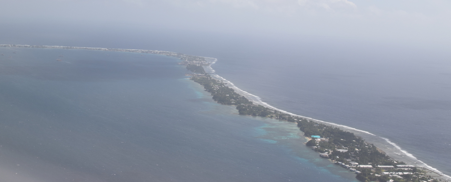
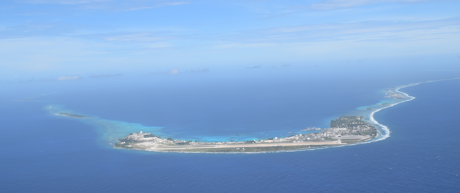
Majuro island itself is a spectacular 50km long, 50m wide, and never more than 2m above sea level. The slim airport runway strip only just fits. (You get a free visa on arrival, right next to the sign informing you that the border and security services are provided by the US.) Check Google maps for such an unusually shaped place.
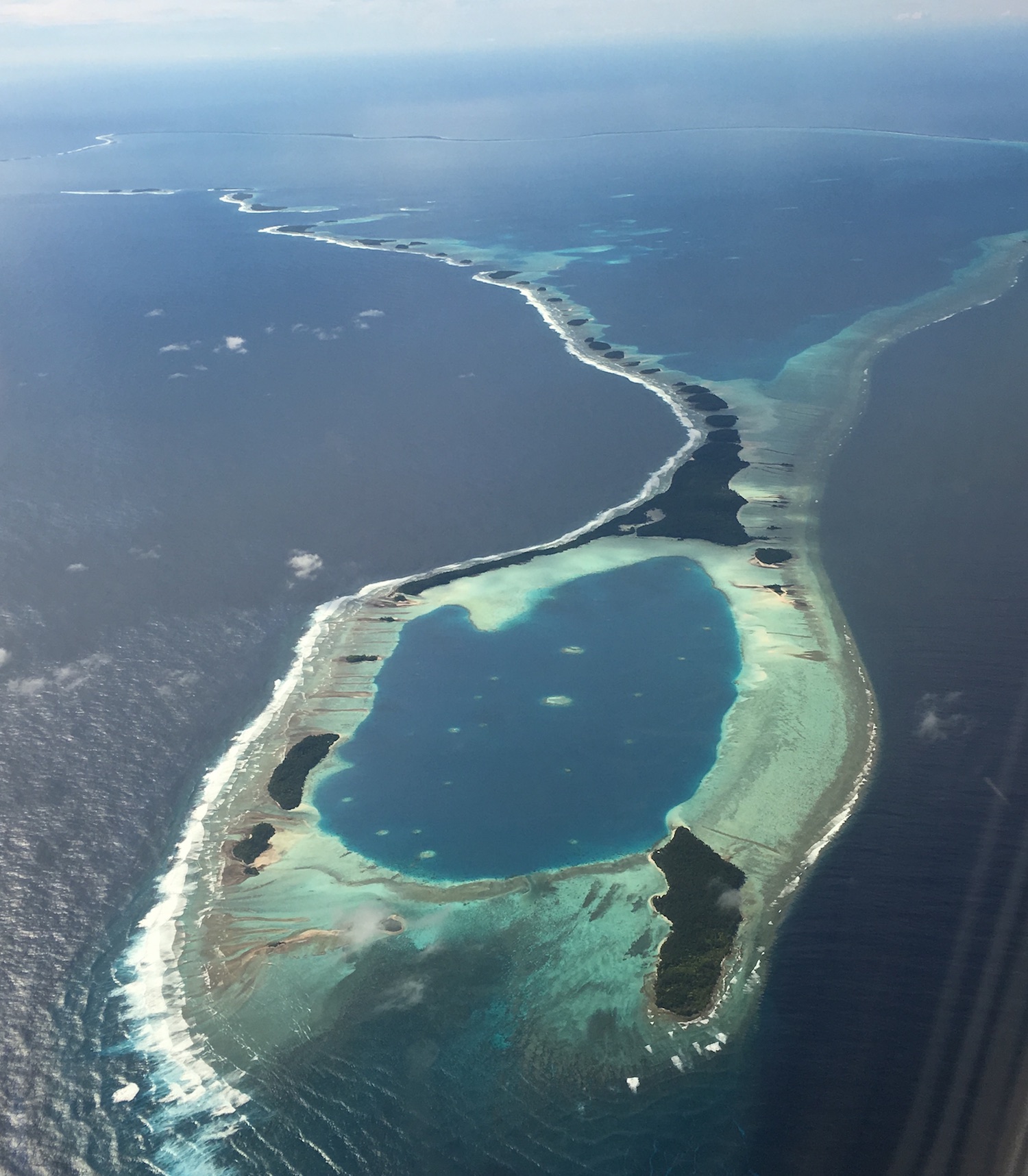
This strip in fact arcs around in a long curve, the largest part of Majuro Atoll in which sixty-four islets complete a full oval shaped necklace. This creates a calm lagoon of 300 sq km, home to several large fishing trawlers, including some that appear to be mothballed, rotting away, anchored near the elbow of the island, along with a dozen or so smart yachts and other private pleasure boats at the nearby marina. Yet there are never many boats actually moving about.
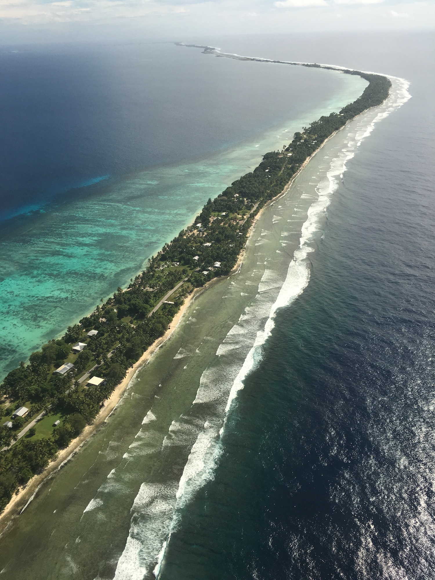
There is basically just one dusty road, which runs the length of Majuro island. It is plied constantly by ambling old taxis, all blaring out classic 70s reggae, which serve more like buses, stopping to pick up different sets of passengers for $1.50 a ride as they mosey along one way and then meander back the other. There are glimpses of glorious turquoise water on both sides all the way down, framing a wonderful tropical atmosphere.
Just outside the airport heading east is the ugly brown compound of the American Embassy. The road here is dotted with buildings and occasional signs declaring that “drinking alcohol is prohibited in this village” or pointing out that smoking in public is illegal.
There are only two hotels and it is six-of-one-half-a-dozen-of-the-other. The Marshall Islands Resort is about 10km east of the airport in the village of Delap. The functional rooms all face the lagoon, as does the fabulous terrace of its Enra bar and restaurant, where you will get the biggest, cheapest and very best tuna poke, marinated various ways, in the whole of Micronesia, and where you can hear a local ukulele nursing a lullaby in tune with the lapping waves. Improbably, it advertises itself as a conference centre, and there is a small beauty salon, with a first class massage, along with the island’s only dive shop. The diving season runs from May to October for World War Two plane wrecks as it can be windy at other times, though there are basic dives in the lagoon all year round. Next door to the resort is the Waan Aelon centre for the construction of Marshallese canoes, from where you can take a ride in the bay.
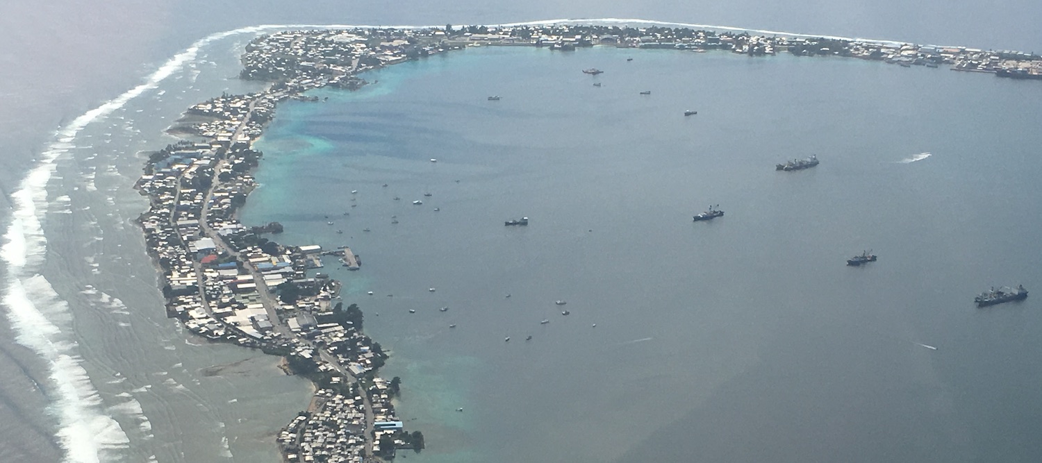
The Robert Reimer Enterprises Hotel is 3km further along in the main town of Uliga, where a handful of beefy Americans (military? mercenaries? missionaries?) hang out at its Tide Table cafe and restaurant, an indoor air-conditioned oasis, which has excellent fruit smoothies. The only other foreigners we see are a few Asians and a handful of Mormons teaching in local schools. Around here is a genuine community with a dozen or more supermarkets where you can pick up food and drink for your day trips, cheap Hawaiian shirts to add to those you bought in Baileys in Waikiki, and even occasional Marshall Islands branded T-shirts. There are also a score of small restaurants, mostly with Asian flavours. But there are only derelict remnants of what used to be the bowling alley and the cinema.
The Marshall Islands have been struggling and Majuro feels a bit run down, needing some investment to smarten up what is a naturally stunning place that has clearly been left behind by the outside world. There are some smart houses but there are also quite a few colourful shacks next to tatty beaches covered in rubbish, especially single-use plastics. This Christmas, the local banks offered every citizen a low interest loan to generate consumer activity and by all accounts that had caused the shops to be fuller than usual. While this slice of paradise has not been developed for foreign tourists, it is still buzzing with authentic character, pregnant with unfulfilled potential.
On an island too narrow to accommodate a football pitch, basketball courts are everywhere, always with cracked concrete floors and usually without nets on the hoops. Five minutes after we bought a ball we had a game with local kids in full swing.
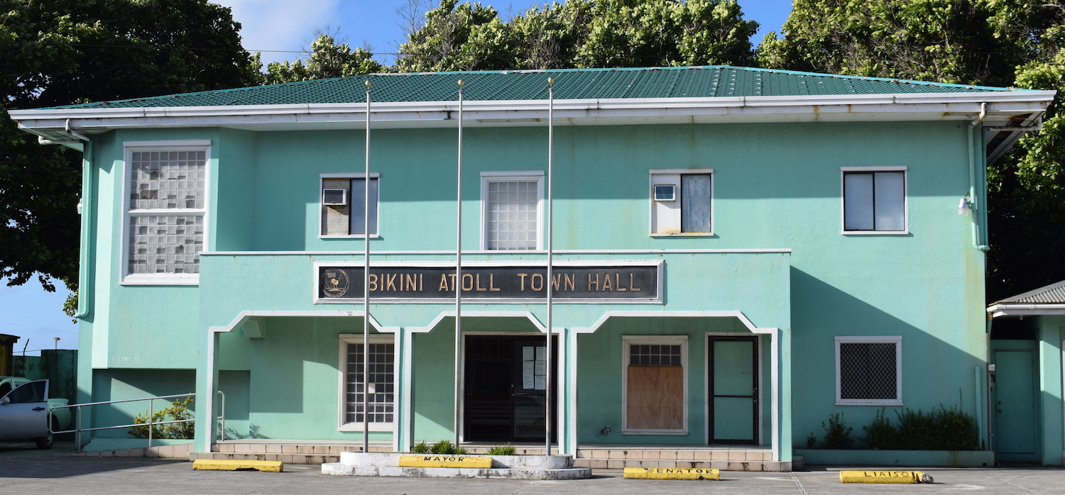
Uliga is the administrative centre where you will find the fire and police stations, the courthouse, the national museum and library archives, as well as one of the most exotic municipal buildings on the planet: Bikini Atoll Town Hall.
Both hotels can arrange big game fishing ($300 for a half day and $500 for a full day), car hire and boat trips. They are also the only places you will get wifi, via a card you purchase at reception.
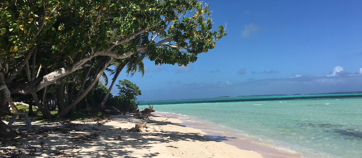
At the western end of Majuro island is the town of Laura (named by the US military after Lauren Bacall), thick with palm trees brimming with coconuts and pandanus trees struggling to hold their massive screwpine fruits. Laura beach has astounding views across the lagoon to other islets in the chain. The beach could be stunning too, curving for 50m around the hairpin bend at the tip of the island, but although you have to pay $1 each to enter, supposedly to help keep the place clean and tidy, it is in need of some TLC. Amid the litter and plastic bottles on the sand are bits of rusting boats and cars. You need to bring food and water as well as a towel to lie on as there are no amenities apart from a few picnic tables hiding in the shade.
At the eastern end is Rita (Hayworth). Here there is not much more than a few rocks, but at low tide it is possible to walk across the narrow gap to the next islet and on down the catena to enjoy hidden beaches in complete privacy.
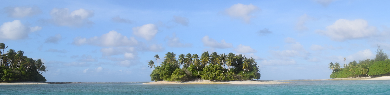
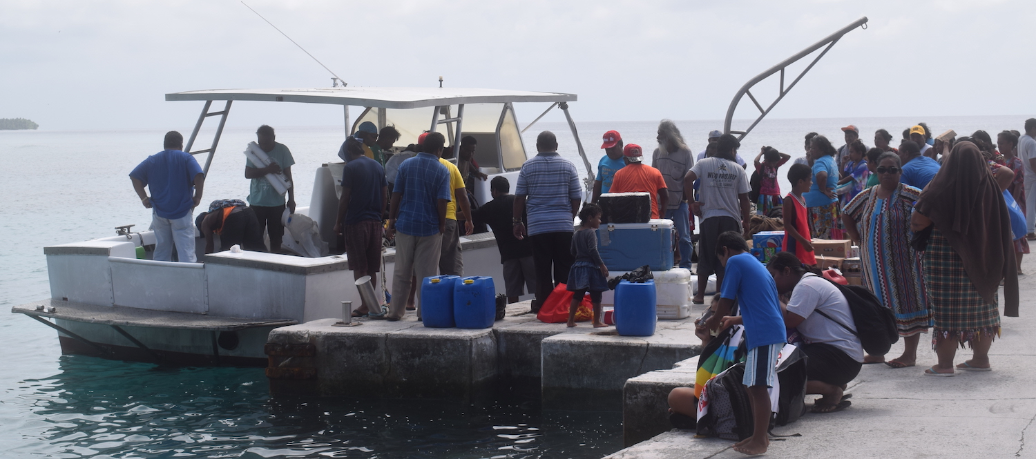
Eneko island on the opposite side of the Majuro Atoll oval is easy to reach for a day out or a few nights at one of the two or three houses there run by the RRE Hotel. A boat leaves every morning around 10am from Shore Line in Uliga, a jetty with a small terrace bar that shelters local characters loafing in its shade, and will return whenever you would like. It takes about 45 minutes to cross the lagoon, where you will find white sandy beaches, loungers, canoes, and warm turquoise water.
There is also a supply boat that leaves from Shore Line on Monday, Wednesday and Friday mornings, somewhere between 9 and 11 depending on how much is to be loaded and how early the skipper gets up, that goes to neighbouring Arno Atoll. Just ask around the regulars for Ronnie and he will let you cadge a ride for about $25. We were again the only tourists crowding on the boat among locals shuffling between atolls. It takes about 90 minutes to cross the 14km, then the boat stays at Arno for just an hour or so to unpack and reload before returning. Ronnie caught a huge tuna off the back of the boat on our return journey.
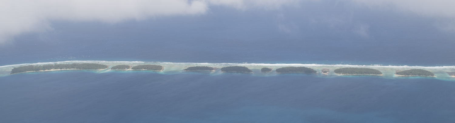
You can come straight back having taken in the gorgeous views, or you can chill out on the pristine beaches on Arno among the 2,000 people who live on the 133 tiny islets that are connected under water by a coral reef system that creates a figure-of-eight with two lagoons. This is more than 5,000km from the nearest continental land mass and it feels such a privilege to be here.
The Marshall Islands run in two north-west to south-east chains: Ratak (Sunrise) to the east, and Ralik (Sunset) to the west. These days, many of these low-lying atolls are swamped by rising seas caused by climate change. Unlike the most famous of the five atoll nations in the world – the Maldives – their cause is unheard. This is probably because they are so remote and hard to access, especially the outer islands even once you have made it all the way to Majuro. The Air Marshall Islands office is in Uliga, but we never saw it open; its adverts claim it flies to outer islands Enewetak, Jaluit, Kwajalein and Wotje, yet it is renowned for its unreliability, with delays lasting days or even weeks.
The UA 154 island hopper does stop at Kwajalein Atoll, which looks dazzling when approached from the air. But this 15 sq km has been sequestrated by the US as a military installation with runway added. So currently only American citizens may enter.
However, from 2018 Kwajalein will be the base of the diving liveaboard that is the main way to access any of the 23 islets in Bikini Atoll.
In 1946, Bikini Atoll’s 161 residents were all forcibly evicted from the 5 sq km surface of islets that circle a 370 sq km lagoon in order to make way for US testing of atomic bombs. They were initially promised they could return soon after. However, following twenty-three nuclear tests that vaporised the islands of Aerokojlol, Bokonijien and Nam, leaving the entire atoll uninhabitable thanks to radioactive contamination, they remain displaced to this day. Hence, the local government building is in Uliga in Majuro, where officials told us they expect it will be at least another two or three hundred years before they will be able to go back home.
It takes two days from Kwajalein, three from Majuro, to sail to Bikini Atoll on the north-west edge of the Marshall Islands. The only licensed operator is Master Liveaboards. The two-week charter runs from May to September and goes twice a month as long as there are at least ten people on board. It costs about $6,000 each. But you get to dive not only the massive HIJMS Nagato, a Japanese dreadnaught battleship, but also the USS Saratoga, the world’s only diveable aircraft carrier, down at about 50m. And what an appropriate metaphor for the Republic of the Marshall Islands: so far away, so hard to get to, so virtually nobody comes, yet so outrageously amazing.