
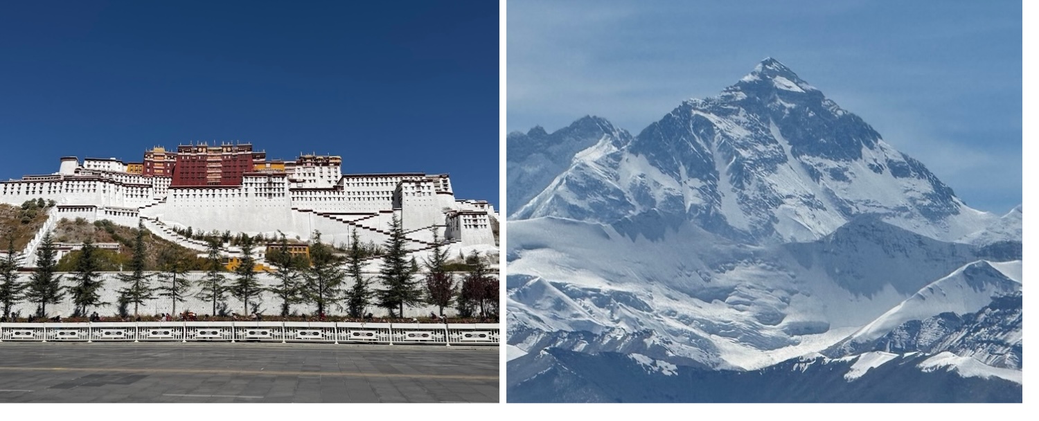
The global A-list icons of the Winter Palace of Dalai Lamas in Lhasa and the greatest mountain on earth at the Nepalese border are at either end of a 600-kilometre classic journey that frames a visit to Tibet. Along the way we get under the skin of Tibetan Buddhism, and marvel at other legendary Himalaya peaks, barren plains and sacred lakes. This is all after the world’s highest altitude train ride.
The remnants of hippie Tibet are long gone, now the Chinese government is putting in place decent roads, hotels, mobile data connections and other facilities to attract wealthier visitors. However, foreigners cannot explore the Tibet Autonomous Region independently. We are legally required to book confirmed destinations, private transportation, and a licensed guide in order to acquire the necessary Tibet Travel Permits, though we can reserve our own accommodation.
That does not mean we are under strict control. We are not, no more than the rest of China anyway, which is of course now more open than ever. We are free to wander off on our own and go more or less wherever we want.
Online there are many travel agencies offering to sort permits and all-inclusive 7-10-day guided packages from Lhasa to Everest and back. Some of those will sculpt a private bespoke tour for us, which can at least bypass crowded groups, give us our own private vehicle with a dedicated English-speaking guide, enable us to choose our own better class of hotels, and allow add-on locations to the standard issue.
We arranged our 13-day tour through Tibet Vista. They were flexible when we were putting together the itinerary, and then flexible again when we needed to change it all after an earthquake affected our train in, and when we needed to get to Everest a few days earlier than scheduled because low cloud was forecast, typical hazards in Tibet. They were also efficient in sorting visas and tickets, and Kunga, our guide, is easy company with detailed knowledge he was happy to impart when going the extra mile every time we wanted to pull up for another photo or a look around another corner. Highly recommended.
Since the 1950s, the currency in Tibet has been the Chinese renminbi. Although some tourists complain that prices can rack up because of the need for permits and guides and vehicles and what-not, basics such as accommodation and other living costs are cheap. For example, the St Regis is the most expensive hotel in Lhasa and even in the peak month of October it costs about ¥1,000 or €130 a night. Overall, Tibet is not terribly expensive, and pales compared to neighbouring Bhutan, for example.
Cash is used more widely in Tibet than many parts of China, and foreign credit cards are widely accepted in major hotels and restaurants. That said, I strongly advise setting up an Alipay or WeChat account as their payments are universally accepted, even by beggars on the street.
The official language is of course Chinese, which everyone can speak, though they prefer to use Tibetan. Our go-to words are tashi delek and took jay chay.
Traditional tea houses, which also sell basic foods such as noodle soup and momo dumplings, are extremely popular. In restaurants, the local delicacies are yak meat cuts and stews, hand-pulled lamb ribs, and blood sausages, all of which are delicious.
Oddly, but presumably to maintain territorial singularity, Tibet shares the same time zone as Beijing, more than 3,000km east, rather than say Bangladesh, which is on the same longitude and is two hours behind. That means sunrise and sunset are later than you might expect.
It is dry here for nine months of the year, and perhaps contrary to popular perception the annual average snowfall is only 45cm, though it is concentrated in the mountains. Despite a mean temperature of roughly 1°C to 9°C, it has extreme weather. Summers can reach 23°C in the day while winters can plunge to -10°C at night. For clear skies and accessible mountain passes, the best times of the year to come are May-June and September-October, when the temperatures will average 11°C to 16°C in the day and 0°C to -5°C at night.
Some people like to target their visit for cultural and religious festivals. The oldest is Losar, the Tibetan New Year, at the start of the lunisolar calendar, which usually falls in February or March, when it is the thing to hoist colourful prayer flags from hilltops and toss roasted barley flour into the air to call for good luck. The holiest is Saga Dawa, which celebrates the birth and enlightenment of the Buddha, during the whole of the fourth lunar month, particularly drawing pilgrims to Mount Kailash in Western Tibet. The biggest in Lhasa is Shoton, held in mid-August, featuring folk opera, yoghurt-eating and yak-racing.
We came in October for the best chance of clear skies over Everest. It was easy to get sunburn during the day and freeze at night. We saw few Western tourists but in Lhasa we could not move for Chinese coach parties.
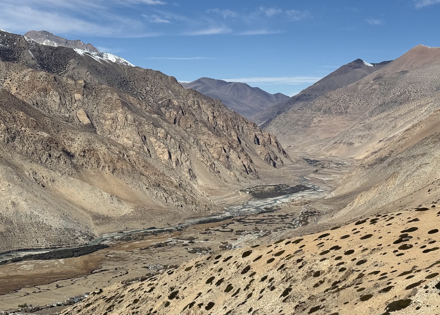
The Tibetan Plateau, north of the Himalaya Mountains and west of the Central China Plain, is an immense land mass consisting largely of rolling barren hills and verdant pastures, towering snow-capped mountains, deep gorges and turquoise lakes. Only about 3.6 million people are spread across this vast area, which averages 5,000m above sea level, and reaches well over 8,000m in the Himalaya, and so is unsurprisingly known as the Roof of the World. Several mighty rivers originate here, including the Ganges, the Indus, the Mekong, the Yangtze and the Yellow. No wonder it is also referred to as the Water Tower of Asia.
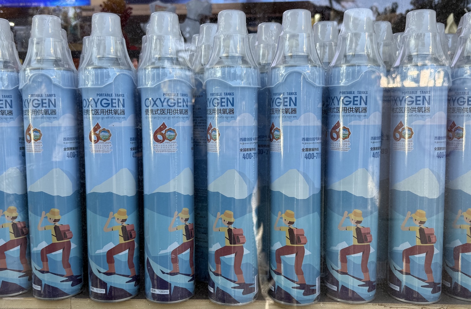
As the atmosphere is much thinner and the proportion of oxygen much lower here, many travellers experience headaches, fatigue and sickness, with severe cases requiring medical attention. Many suck from portable oxygen bottles, which are available from every corner store. On the Lhasa-Everest route, hotels usually feature bedrooms with oxygen tanks for emergency use and diffusers to pump moisture into the air, as well as communal oxygen lounges for recovery.
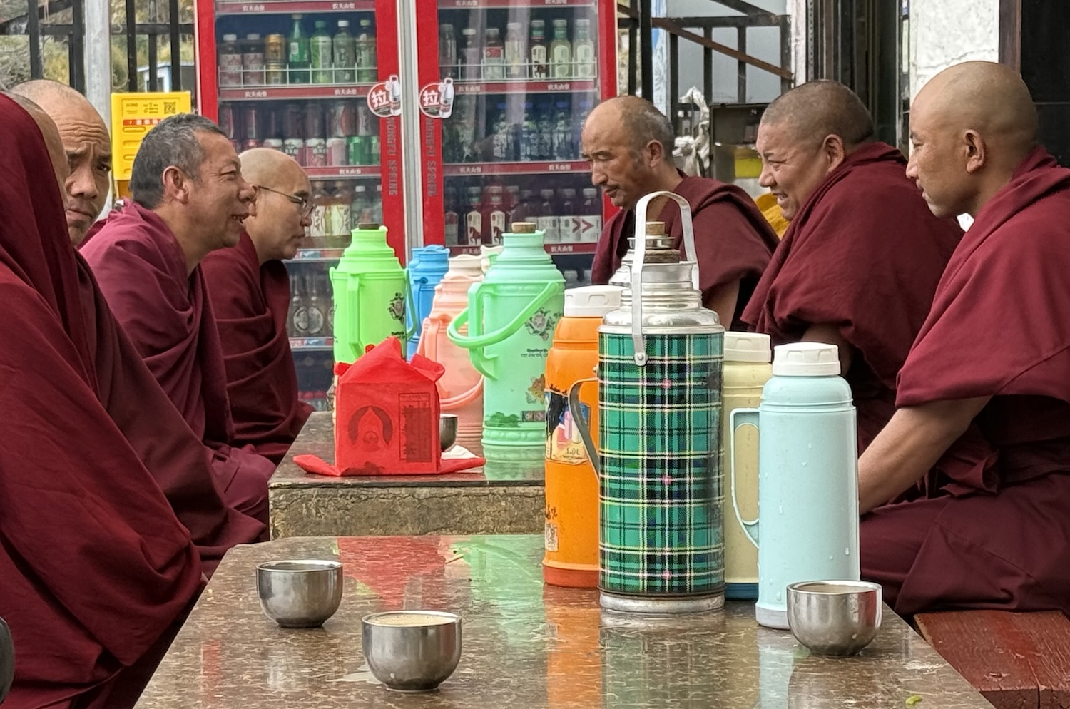
This land is of course of enormous religious significance, as the home of a hugely influential strand of Buddhism, and everyone – including travel bloggers who steer well away from politics – have to be circumspect.
The story begins with the Zhangzhung Kingdom, which is thought to have been founded about 500 BC around Mount Kailash in Western Tibet. Incidentally, there is no recorded ascent of this 6,638m-high peak, and climbing it is now prohibited by the government because of its spiritual significance to Tibetans, many of whom consider it the centre of the universe, and to Hindus who believe it is the most hallowed highland in the world.
Hemmed in by natural barriers and forbidding conditions, from barren desert plains to snow-capped summits, which deterred outsiders, the Zhangzhung Kingdom was left to dominate the Tibetan Plateau for more than a millennium. In this time, it fashioned a unique culture. It created its own script, which allowed the drafting of its own history and myths for the first time, and, crucially, its own faith, Yungdrung Bonism.
Followers of Bon, called Bonpos, claim that many Tibetan customs still prevalent to this day stem from the Zhangzhung Kingdom. These include the kora, walking – and sometimes kowtowing every few metres, lying prostrate with foreheads touching the earth, in a sort of burpee movement – in a clockwise direction around religious buildings and icons. Believers usually carry 108 threngwa beads on a string, which are used to count through the mantras spoken aloud on the kora. The longest circuit is around Mount Kailash, a 52km trek.
In addition, Bonpos say they started the traditions of hanging prayer flags and scattering longda, small bits of paper printed with mantras, that are commonplace today. Other standard practices we encounter that likely date from this period include burning incense, lhasang, to dispel evil spirits at temples, piling mani stones at major spiritual sites from shrines to mountains, hanging thangka, paintings on cotton or silk scrolls colourfully depicting deities, and wearing hand-woven red bracelets, called a vajra knot, to block negative energy.
Bonism
Bonpos believe in four main deities, known as the Transcendent Lords: the Mother, the God, the Procreator and the Teacher. Each of these has 250 attendants, making 1,004 enlightened figures in all.
In essence, they imagine that one of these Lords, the Teacher, Tonpa Shenrab Miwoche, attained enlightenment many years before Siddattha Gotama, known as the Buddha. Sadly, they feared that most of his ancient teachings were lost during the eighth century when Buddhism took over in Tibet. Luckily, they later claimed these teachings had in fact been hidden away only to be rediscovered in the eleventh century, when Buddhists started to fragment, which triggered a renaissance in Bonism.
Even today, images of Bon deities are commonly incorporated into the design of buildings, apparently making them castles or dzongka capable of resisting the evil forces of the outside world. A major emblem of Bonism is 卍, a left-facing swastika (the Nazis’ was right-facing) that symbolises indestructability.
These days, as many as 10% of Tibetans still say they are Bonpos, and they have almost 300 active monasteries, convents and hermitages. Their premier shrine, the Menri Monastery near Shigatse, home of the Abbot who is the Bon spiritual leader, was destroyed during the Chinese Cultural Revolution. It was refounded in Dolanji in Himachal Pradesh in India in 1967, where it opened in 1978.
Although the historical record is shaky, the Zhangzhung Kingdom seems to have been conquered by Songtsen Gampo, of the rival Yarlung Dynasty from Central Tibet, who were also Bonpos, sometime in the early seventh century. Gambo united all the peoples of the plateau, declared himself king, and established his capital at Lhasa, where he put up the major edifices we come to visit today.
Gampo (who reigned from 618 to 627) is the first of three so-called dharma or religious kings – followed by Trisong Detsen (755 to 797), and Ralpachen (815 to 838) – who are revered to this day for expanding the Tibetan Empire, which brought them into contact with north India, from where they imported Buddhism, establishing it as the state religion and investing in monastic teaching. It was Detsen who was responsible for the persecution of Bonpos, causing them to flee to the eastern and northern fringes of Tibet, while several aspects of Bonism were fused with Indian Buddhism to form Tibetan Buddhism. Understandably, we will encounter these three figures many times during our tour.
Buddhism
Buddhists do not believe in any kind of deity.
Their legend has it that 35-year-old Siddattha Gotama achieved enlightenment in 528 BC after meditating for more than a month under a Bodhi fig tree in north India. His claim to have been liberated from duhkha, suffering, and samsara, the painful cycle of re-birth, by reaching nirvana, caused him to become the Buddha, or the Awakened One.
His dhamma, teachings, are based on Four Noble Truths:
- Life involves suffering
- This suffering is rooted in our attachment to ideas and objects that inevitably change
- It is possible to end suffering in this life through annihilation of the illusion of the self
- The route to ending suffering is The Middle Way between the extremes of clinging and aversion, both expressions of attachment, to become equanimous
Buddhists believe this is achieved through the Noble Eightfold Path of practices: the right view, right resolve, right speech, right conduct, right livelihood, right effort, right mindfulness, and right samadhi or meditative awareness. They say that only these together can cultivate wisdom, develop moral conduct, and discipline the mind.
There are four Schools of Tibetan Buddhism:
- Nyingma or Red Hats, founded when Indian Buddhist texts were translated into Tibetan during the eighth century, emphasizes the practice of dzogchen, which aims to reveal the innate purity of the mind
- Sakya or White Hats, founded in 1073, prioritizes systematic scholarly study and rigorous ritual frameworks
- Kagyu or Black Hats, founded in 1121, stresses meditation and experiential transmission from teacher to student
- Gelugpa or Yellow Hats, founded in 1409, highlights strict monastic discipline and expansive philosophical debate, and has become the dominant tradition under the Dalai Lamas
Off the back of a series of severe droughts, the rise of regional warlords typical across Central Asia at the time, and the weakening political influence of Buddhism, the assassination of King Langdarma in 842 triggered the collapse of the Tibetan Empire. This begat centuries of fragmentation, during which two new Schools of Buddhism were founded.
Continuing to expand Genghis Khan’s empire, the Mongols marched across Tibet in 1240 and imposed a new kind of stability. Although they already ruled China through their Yuan Dynasty puppet regime, they granted separate authority to patron-priests in Tibet. In so doing, they revitalised Buddhism in politics, and established the precedent of an autonomous Tibetan region within the wider Chinese embrace.
When the Mongol Empire disintegrated in the 1350s, Tibet effectively assumed independence, and a parade of family dynasties held sway for almost 300 years until they were replaced in 1642 by secular governments, called the Ganden Phodrang, led by successive Dalai Lamas.
Dalai Lamas
The Gelugpa School, known as the Yellow Hats, had been founded at Ganden Monastery near Lahsa in 1409 by Je Tsongkhapa, a philosopher and tantric yogi. The title of “Holiness Knowing Everything Vajradhara Dalai Lama” was first conferred on their then spiritual leader, Sonam Gyatso, by the King of the Tumed Mongols, Altan Khan, in appreciation of the lessons he had received as he committed his country to Tibetan Buddhism in 1578.
This title was granted to all future incarnations of the spiritual master, what is known as the tulku lineage. Hence, when a Dalai Lama dies, a committee of senior lamas convenes to identify the reincarnation through – let us say – a combination of omens and supernatural methods. Although Westerners may scoff at this process, it is hard to say it is less random than the hereditary principle.
By the time of the fifth incarnation in the seventeenth century, the Dalai Lama had become an ecumenical figure, not just a revered leader of the dominant Gelugpa tradition but also a symbol of Tibetan unity. Hence, Dalai Lamas were entrusted with overseeing the secular Ganden Phodrang governments that began in 1642 and were ended in 1951.
In 1717, the Dzungar Mongols captured Lhasa, causing the Qing Dynasty to invade and evict them three years later, after when the Ganden Phodrang functioned officially as a Chinese Protectorate. When the emperors were overthrown by the Xinhai Revolution in 1911, the Republic of China struggled to establish authority in Tibet as the thirteenth Dalai Lama declared independence (though that was never recognised in international law).
Only two years after the Chinese Communist Revolution in 1949, they drafted the Agreement of the Central People’s Government and the Local Government of Tibet on Measures for the Peaceful Liberation of Tibet, and fourteen years later declared the territory the Tibet Autonomous Region. The fourteenth Dalai Lama fled into exile in India in 1959.
It is worth flagging that Chinese Communist rule was welcomed by many Tibetans who were angry that for decades and centuries the Buddhists had sequestrated the region’s limited resources to embellish their religious monuments rather than improve the living standards of the people. Aural evidence suggests that this strand of thinking continues today, with many concerned less with sovereignty now that China is investing in infrastructure and employment in order to develop tourism.
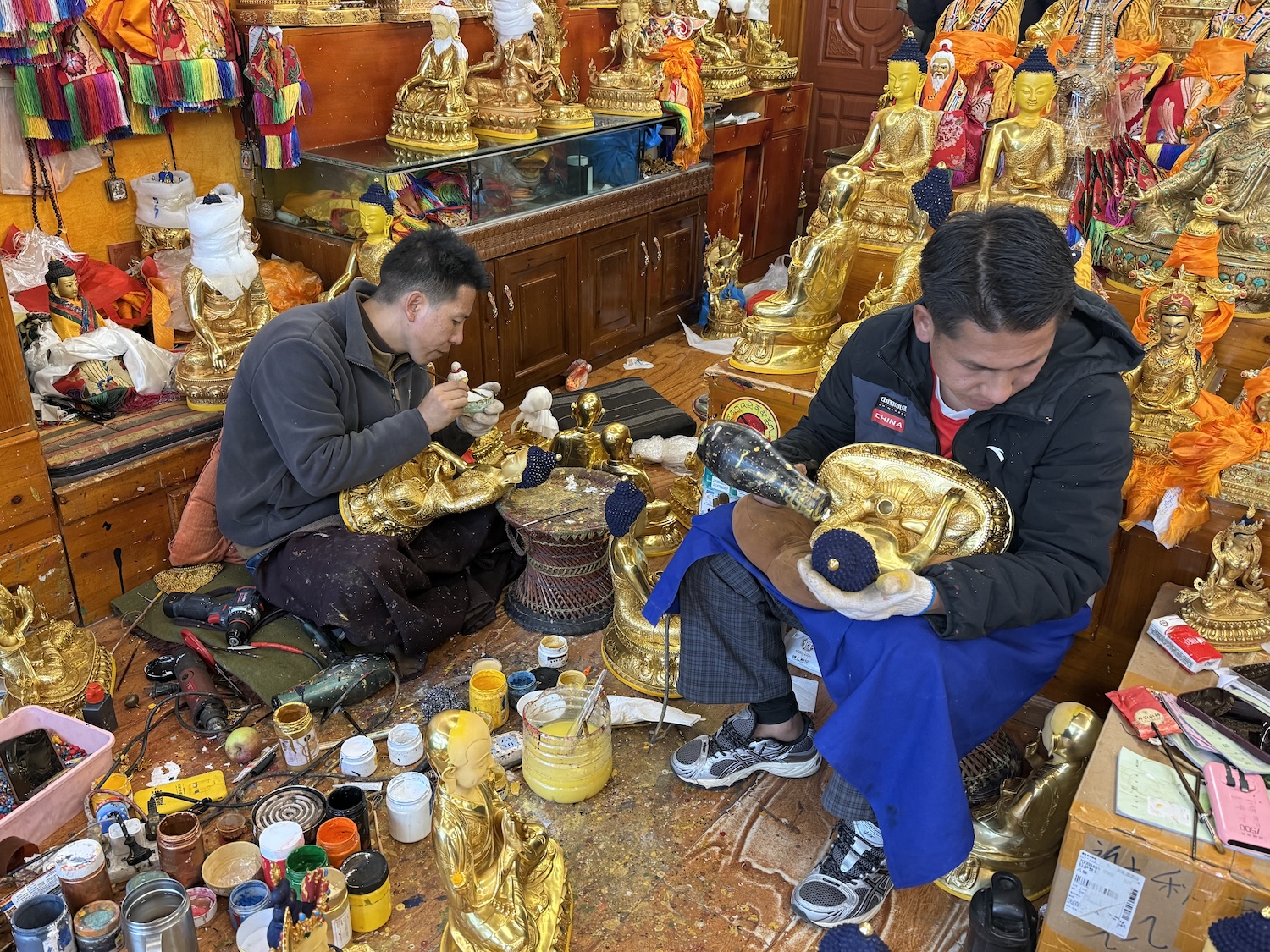
In any case, many Buddhist temples and relics were damaged or destroyed during the Cultural Revolution. Therefore, much of what we see today has been repaired and rebuilt in the past twenty years or so as the Chinese Government seeks to undo some of that damage. Hence, visiting the major shrines today feels like a history lesson in both 1,300 years of Buddhism and the more recent rule of Communist China.
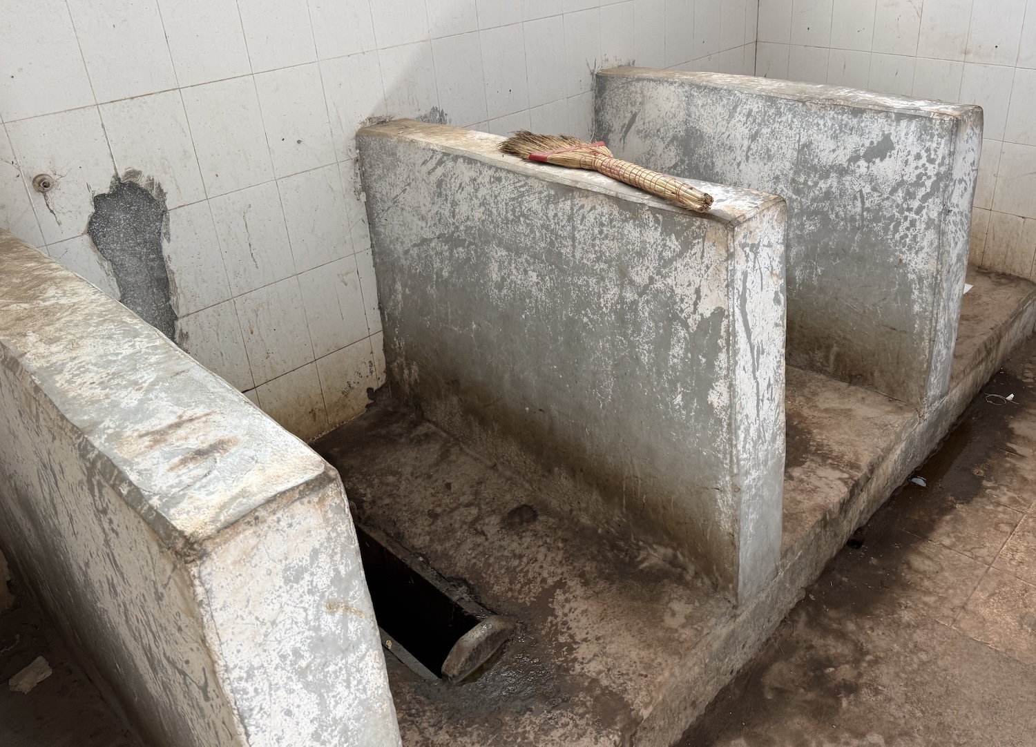
Incidentally, it is evident that tourists care more than locals about the state of the public toilets. Almost everywhere they are not only squat and squalid, decorated by stinky turds on the floor, and invariably lacking both toilet paper and wash basins, but also usually without cubicle doors or dividing walls more than waist high, making them quite an intimate experience.
Sky Train
If you fly into Tibet, you will almost certainly land at Gonggar Airport, 60km north of central Lhasa. This airport is dual use, both commercial and military, so there are strict rules on photography and so on. Taking the plane would not only thrust you straight into the rarified atmosphere of the higher altitude, but it would also mean missing out on one of the world’s great train rides.
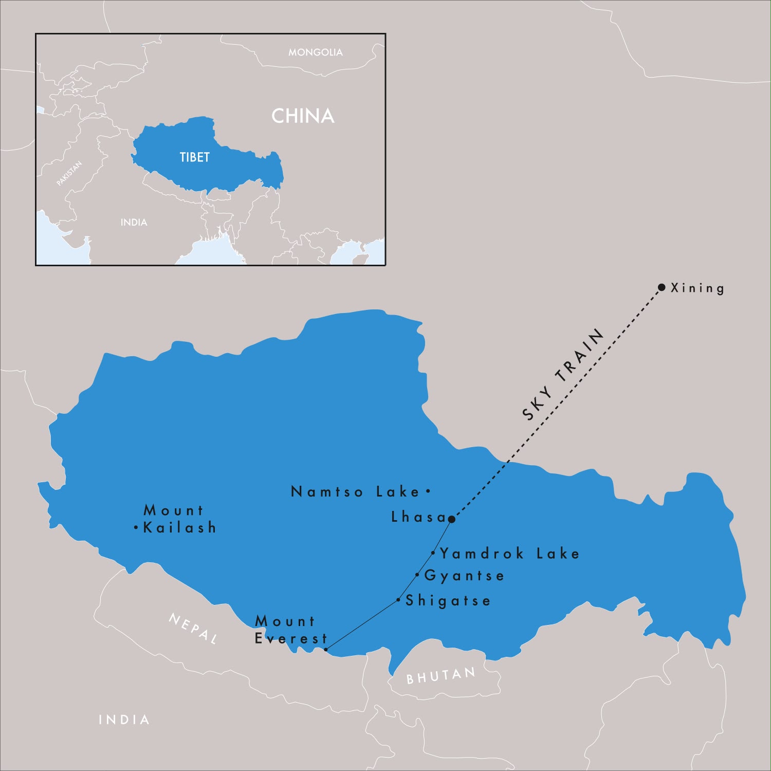
The Sky Train, the highest on the planet, runs for 1,957km and takes more than twenty hours, from Xining in Qinghai Province in China, southwest through the Tibetan Plateau, to Lhasa. Xining is 2,500m above sea level and the train almost immediately passes Qinghai Lake, the largest in China, and travels on almost 1,000km of track that is more than 4,000m above sea level, with spectacular views all the way. It has the additional advantage of a more gradual acclimatisation to the thin air.
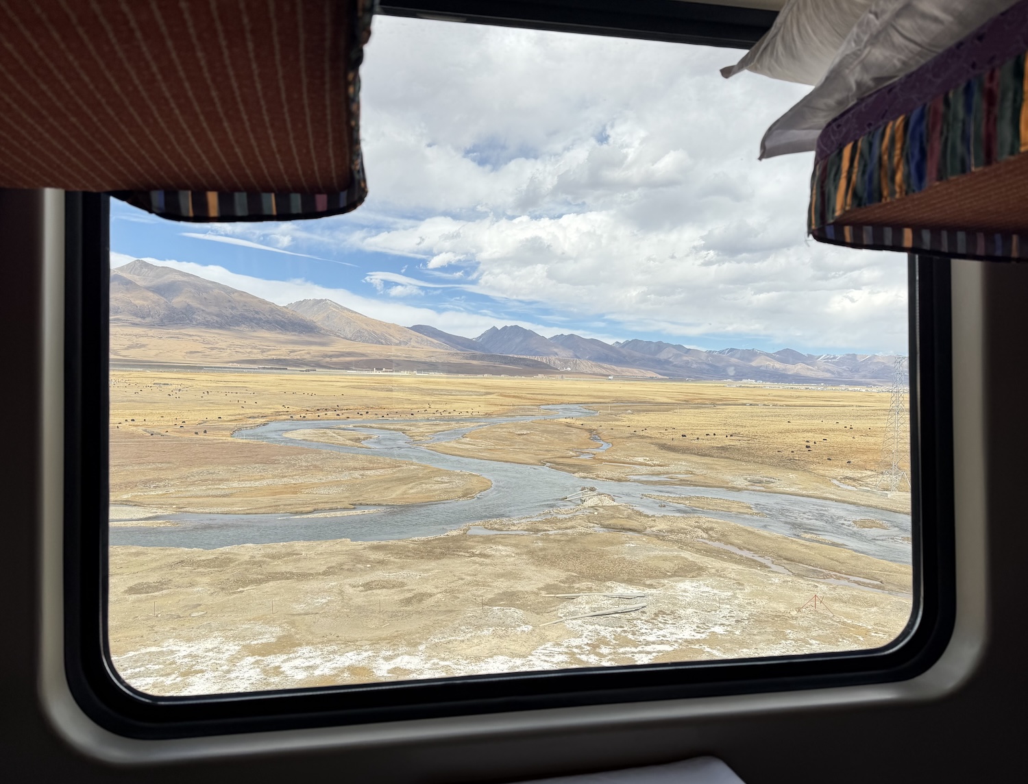
The 815km Xining-Golmud section opened in 1984, the 1,142km Golmud-Lhasa extension as recently as 2006, and it was all electrified in the past decade or so. Obviously, it holds many records, including the highest point in the world on a railway (the Tanggula Pass, 5,072m), the highest station (Tanggula, 5,068m) and the highest tunnel (Fenghuoshan, 1,338m-long and 4,905m-high).
Tickets can be booked by guides, or independently online. They go on sale only fifteen days before departure so there will usually be quite the rush for “Soft Sleepers”, which are premium coaches with four bunks of thick mattresses and cozy bedding in lockable cabins that have oxygen supply ports for use in higher altitudes. Although there are several departures throughout the day, the ones you want leave Xining late in the evening so you can spend all of the following day looking out the window at the Tibetan Plateau.
To board the train, we need to show a physical copy of our Tibet Permit. To receive that, our travel agent will need to mail it to us, but they are allowed to send it only to addresses in China. Therefore, we need to overnight in Xining so they can post it in advance to our hotel here unless we stay elsewhere in China first. The best hotel in Xining seems to be the Sofitel.
Xining, now a city of 2.5m, was on the Hexi Corridor, for centuries a major trade route between Mongolia and Tibet. That means a few days here is an excellent primer for what is to come. For instance, the local dish is Tibetan hand-pulled lamb, so-called because it is served and eaten with fingers; it is everywhere but the outstanding restaurant is Yi Xin Mutton Shouzhua Guan on Baiyu Lane. There are also two significant religious shrines.
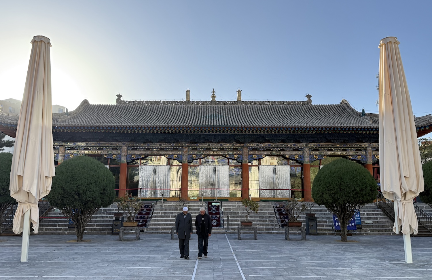
Beautiful Dongguan Mosque was originally built in 1380, though it has been renovated constantly ever since, including in 1921 when its green dome and minarets were replaced by a more Chinese design.
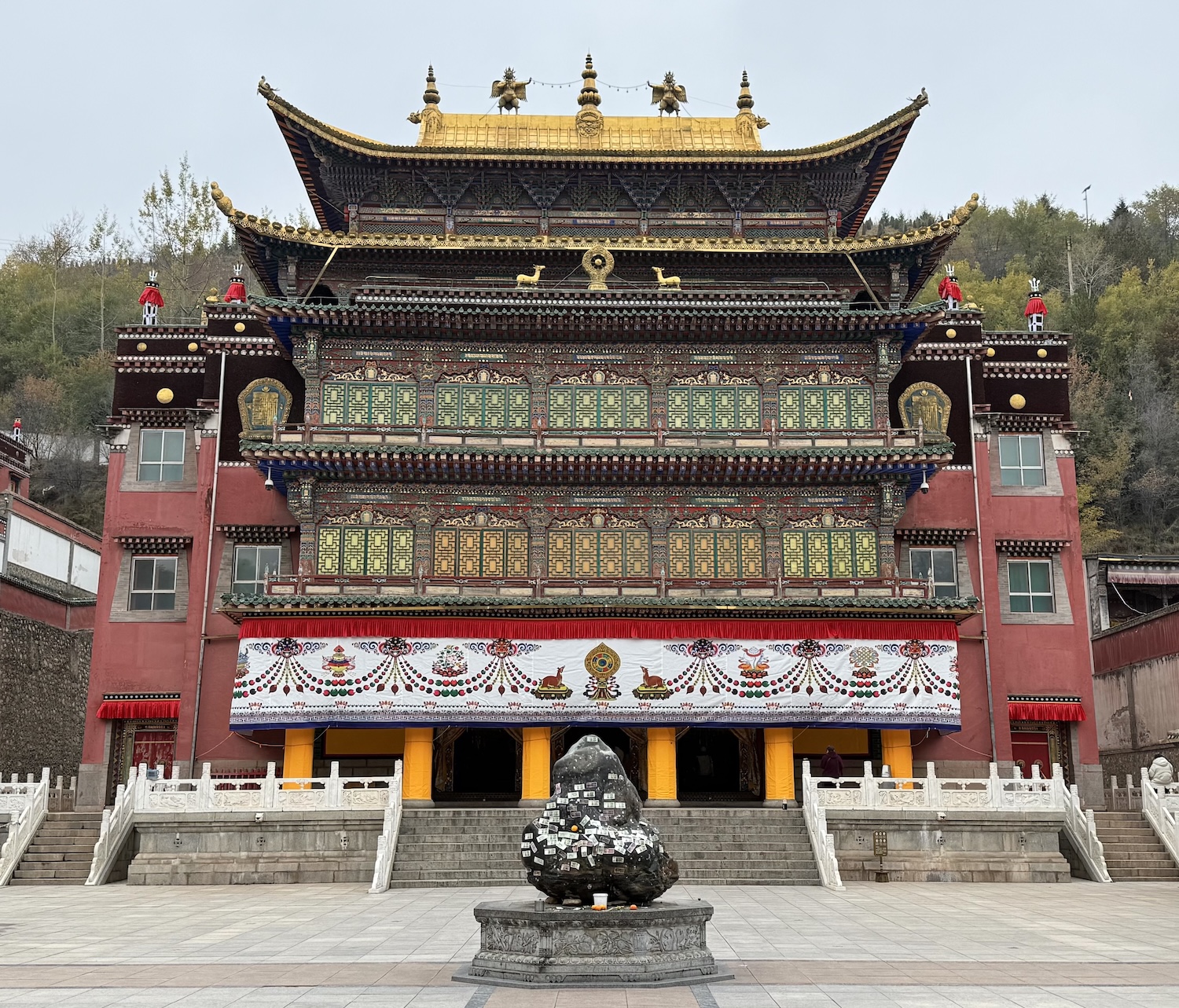
Massive and majestic Kumbum Monastery is a Tibetan gompa or centre for learning, founded in 1583.
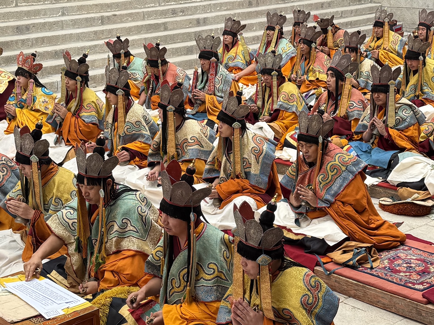
We were lucky enough to be at Kumbum when there was a once-a-year ceremony, typical in dress and style of those at the monasteries we will visit in Tibet.
Lhasa & Around
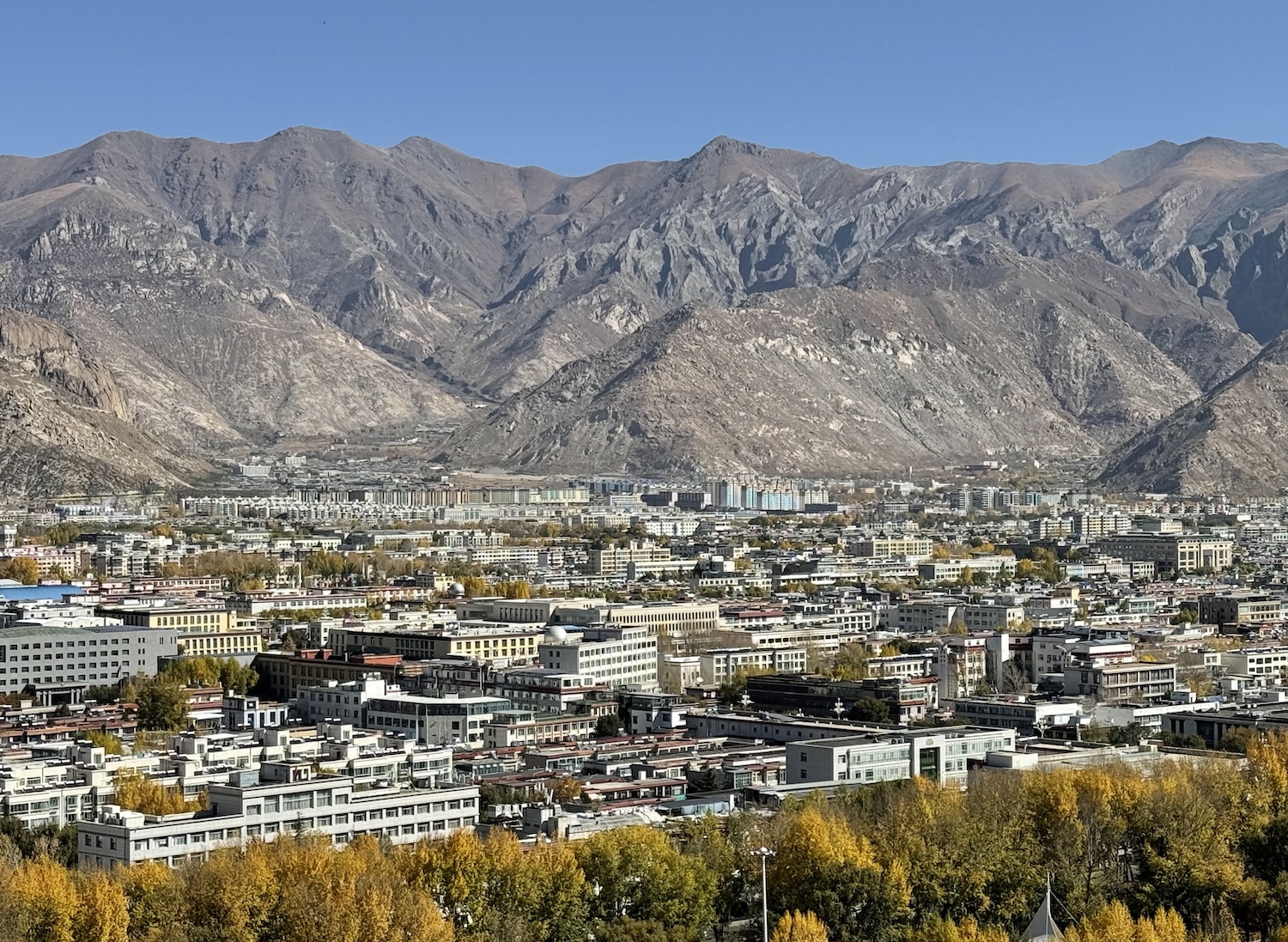
The City of Sunshine is in the middle of the Tibetan Plateau, in a bowl surrounded by beautiful mountains. Its population of around 900,000 sit at 3,656m above sea level, either side of the Lhasa River, which flows west to east. On the south bank is the new town, where there are huge blocks of recently constructed apartments, and on the north side is the Old Town, home of the most prestigious Buddhist venues.
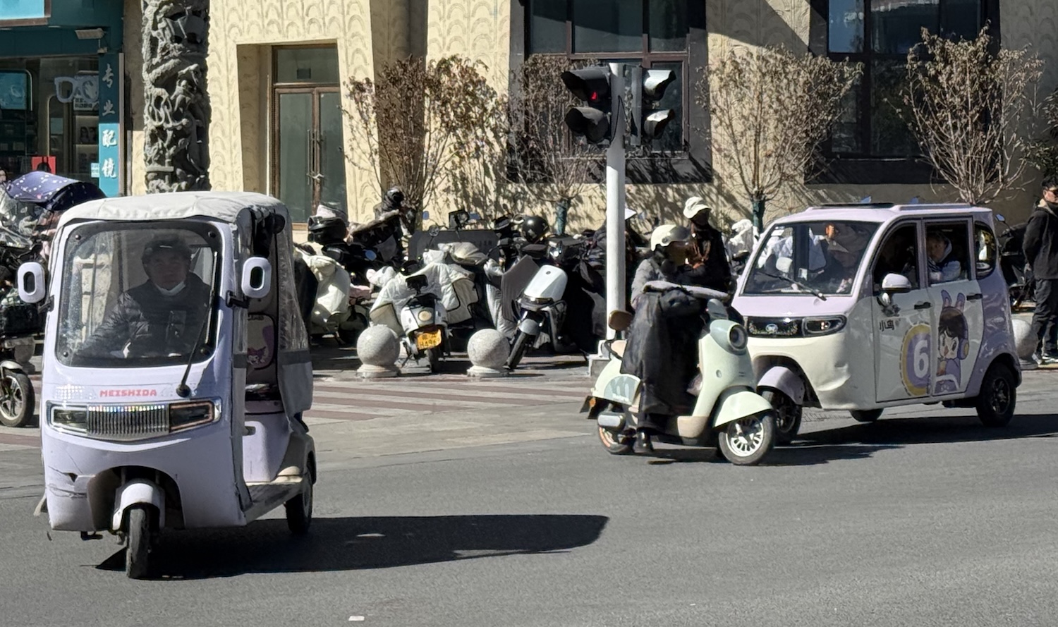
Lhasa is a small city, easy to navigate via the Didi ride hail app and easily-flagged tiny three-wheel “Tibet tuk-tuks”. There is surprisingly minimal security even at the major sites, where we just have to show our passport and walk through airport-style x-ray machines. Incidentally, there is no need to remove our shoes at any of the temples or palaces across the territory.
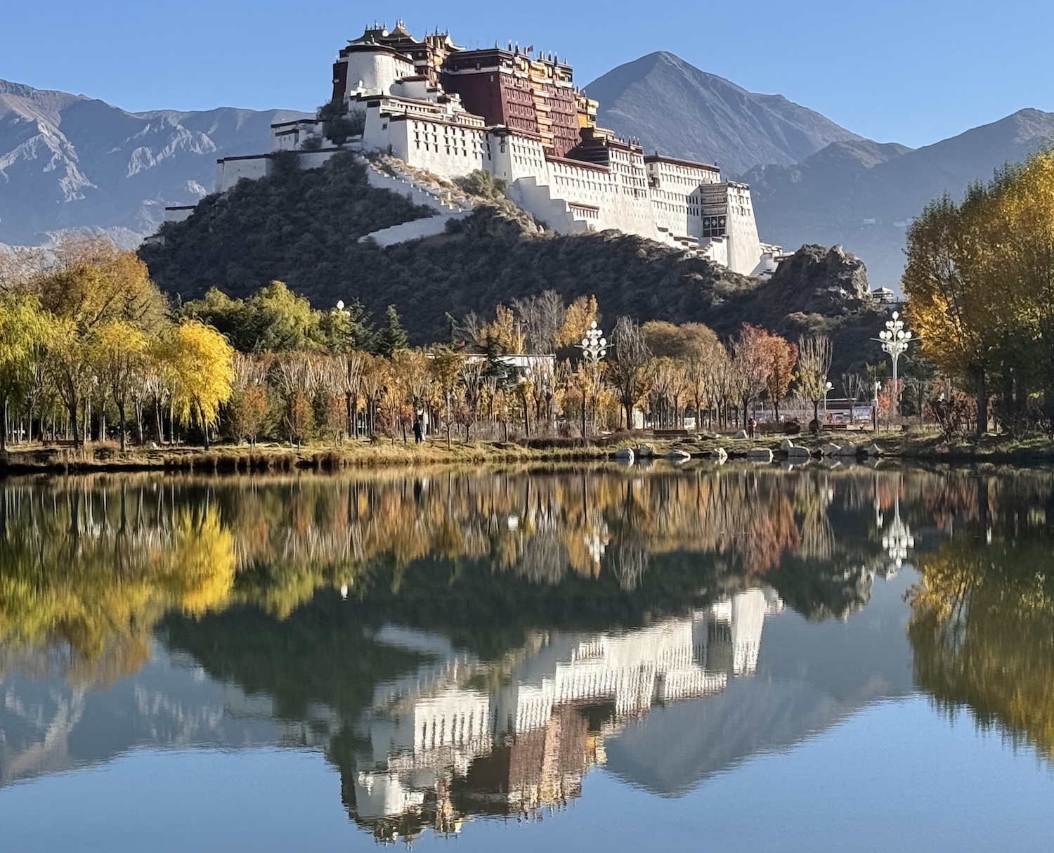
Potala Palace, which dominates the city atop Mount Marpo Ri, is of course a UNESCO World Heritage Site (jointly with Jokhang Temple and Norbulingka Palace). This sprawling 13-story fortress was built in the early seventh century by King Songtsen Gampo, founder of the Tibetan Empire, and has been home to every Dalai Lama since the fifth up to the fourteenth before his exile in 1959. Its iconic and imposing red and white structures, with shambu pleated fabric valances rustling in the wind, are copied in buildings across Tibet and the wider Buddhist world.
It was badly damaged in the 1960s, when there were almost 3,000 monks here. Today, there are fewer than 600, though the building is back in first rate condition. There is a small tower near the Old City Gates to the west, which gives the perspective we find on the back of the ¥50 note, and behind that is the best view of all, from Tuanjie Park.
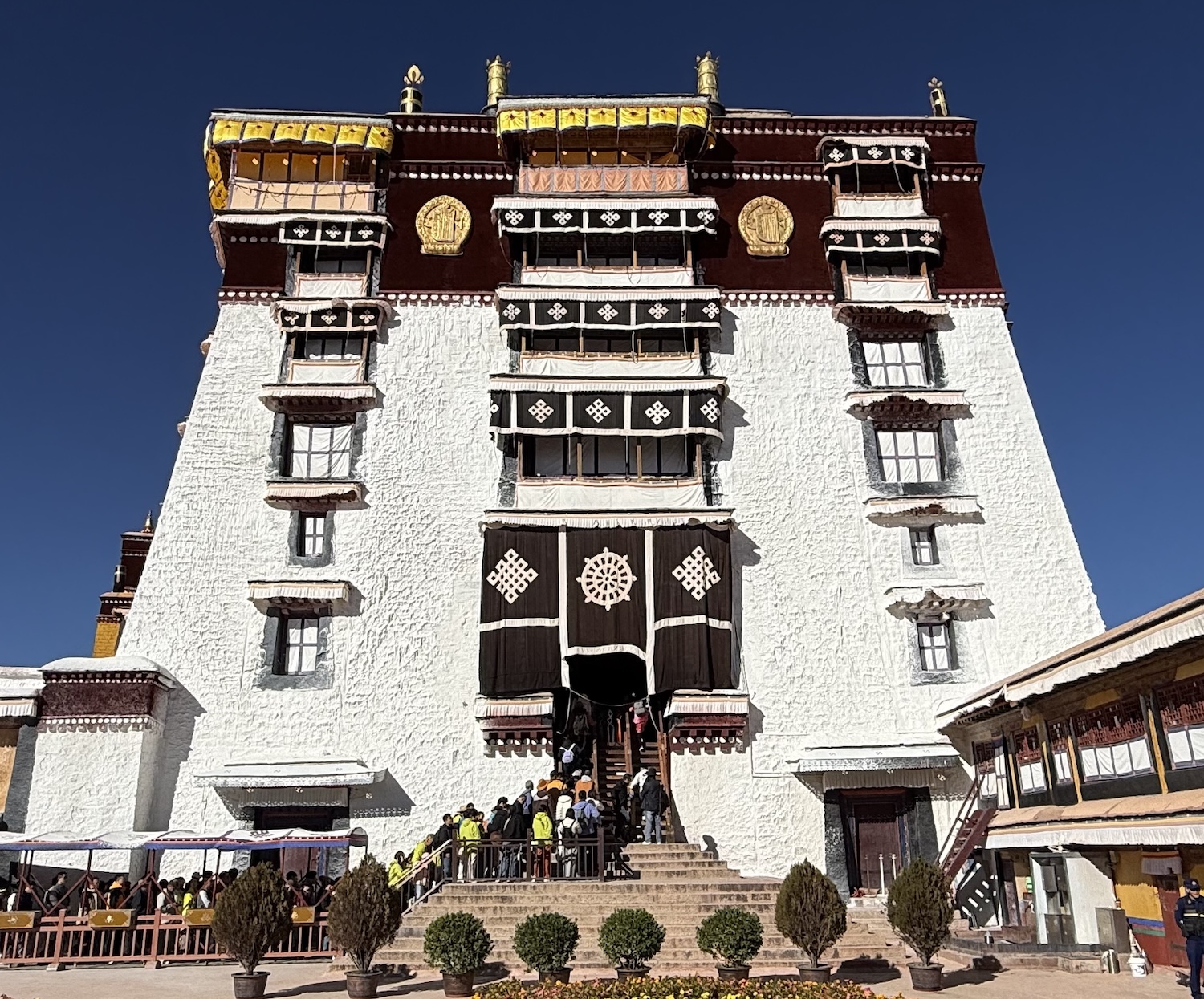
The red buildings house the religious functions, and it is these we are allowed to visit by walking – mostly in slow-motion, given the altitude – up the outside stairs. They include numerous chapels and shrines, the private quarters of the Dalai Lamas, and the tombs of those from five to thirteen (most Buddhists, including religious leaders, are cremated, though Dalai Lamas are buried as cadavers). Like all the major sites in Lhasa, a strict policy of preventing photos inside is rigorously enforced, though the provincial shrines are more relaxed. The white buildings held the governments of the Ganden Phodrang between 1642 and 1951, and are closed to the public.
Outside the Palace walls is a kora route, in a clockwise direction, which takes about half-an-hour to complete for those walking. Pilgrims from all over come here to do it, especially older people preparing for their next life.
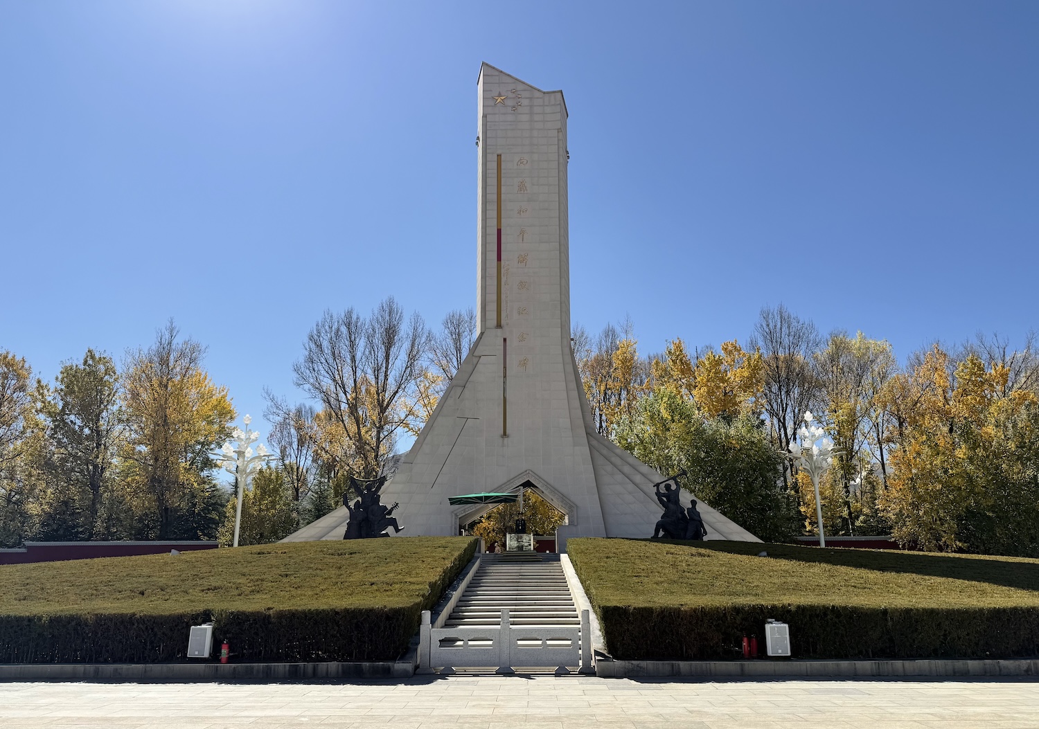
Opposite the Palace to the south is a huge square. The central feature is a Monument to the Peaceful Liberation of Tibet by China, flanked by giant portraits of President Xi on one side and five historic leaders of the Communist era on the other: Mao Zedong (1949-1976), Deng Xiaoping (1978-1992), Jiang Zemin (1992-2002), Hu Jintao (2002-2012) and Xi Jinping (2012-).
Jokhang Temple (which means House of Buddha), also built by King Gampo, is in a unique blend of Indian, Nepalese, and Tibetan architectural styles. It is the spiritual heart of Tibetan Buddhism because it enshrines the revered 2,500-years-old bronze statue of a twelve-year-old Jowo Shakyamuni, the historical founder of Buddhism, which is believed to have been blessed by the Buddha himself. Thankfully, it was hidden by lamas during the Cultural Revolution to ensure its safety, though the temple itself was badly damaged by the Red Guards.
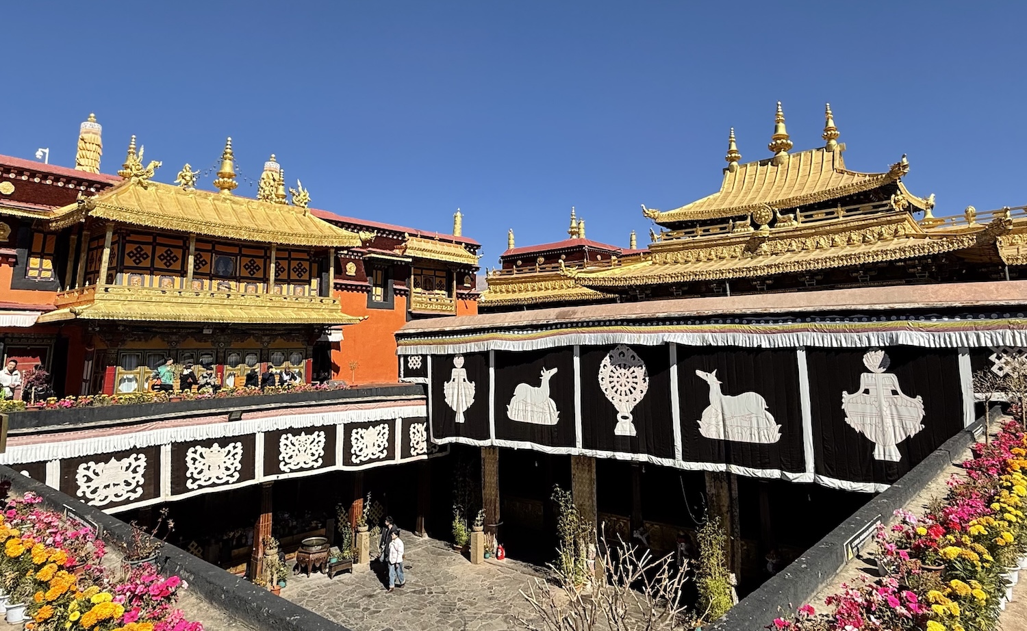
Whenever we enter any shrine within any temple, we kora around the central icon before praying or just admiring. The atmosphere is invariably chaotic as worshippers, unmediated by any figure of authority, wander hither and thither offering gifts of yak butter, barley wine, and money (relics are invariably littered with yuan notes, though there are also QR codes for payments by Alipay and WeChat). They also lay prostrate, kowtowing, throughout all temples, though one of the busiest spots to do that is at the front of Jokhang Temple.
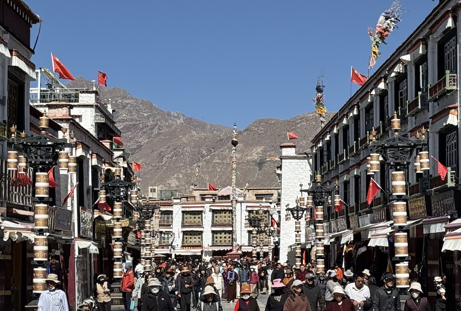
Barkhor Street, a route of shops and stalls that circumnavigates Jokhang Temple, is probably the busiest kora course in Tibet. It is in the heart of one of the best kept old towns I have ever seen, and there are numerous offshoot roads and alleys that create a huge nest of constant activity.
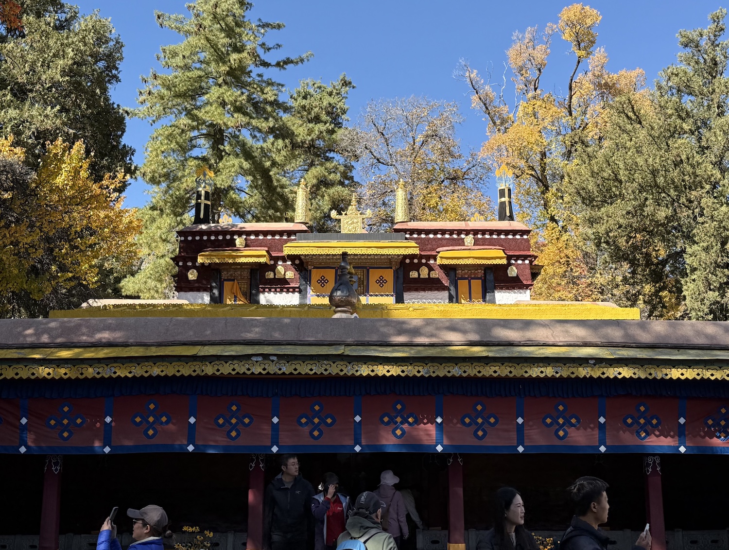
The seventh Dalai Lama is known to have had health issues, and in the 1750s he commissioned a Summer Palace be built around hot springs on the lowest elevated ground in Lhasa (about 5m lower than anywhere else). The result was Norbulingka, meaning ‘treasure garden”.
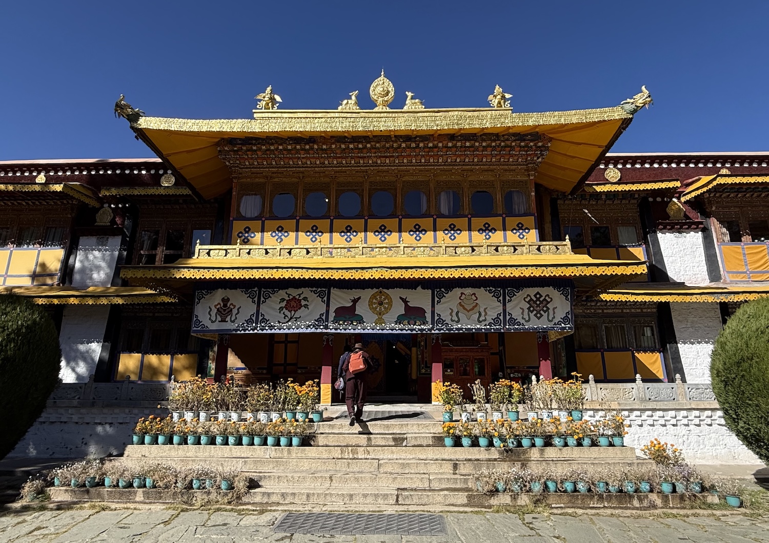
The fourteenth Dalai Lama built a home inside the Palace. It was completed in 1956, but he lived here for only two years. Inside it is the only known public picture of him in Tibet. It is not a photograph and it is not prominent, it is part of a mural painted before 1959, and to see it you have to peer past a glass cabinet containing his throne.
About 7km northwest of Potala Palace is Drepung Monastery, so large it is like a city in itself. Built in 1416, this early Gelugpa monastery, the biggest Yellow Hat shrine in Tibet, was key to establishing their hegemony before the fifth Dalai Lama moved the centre of power to the rebuilt Potala Palace, in 1648.
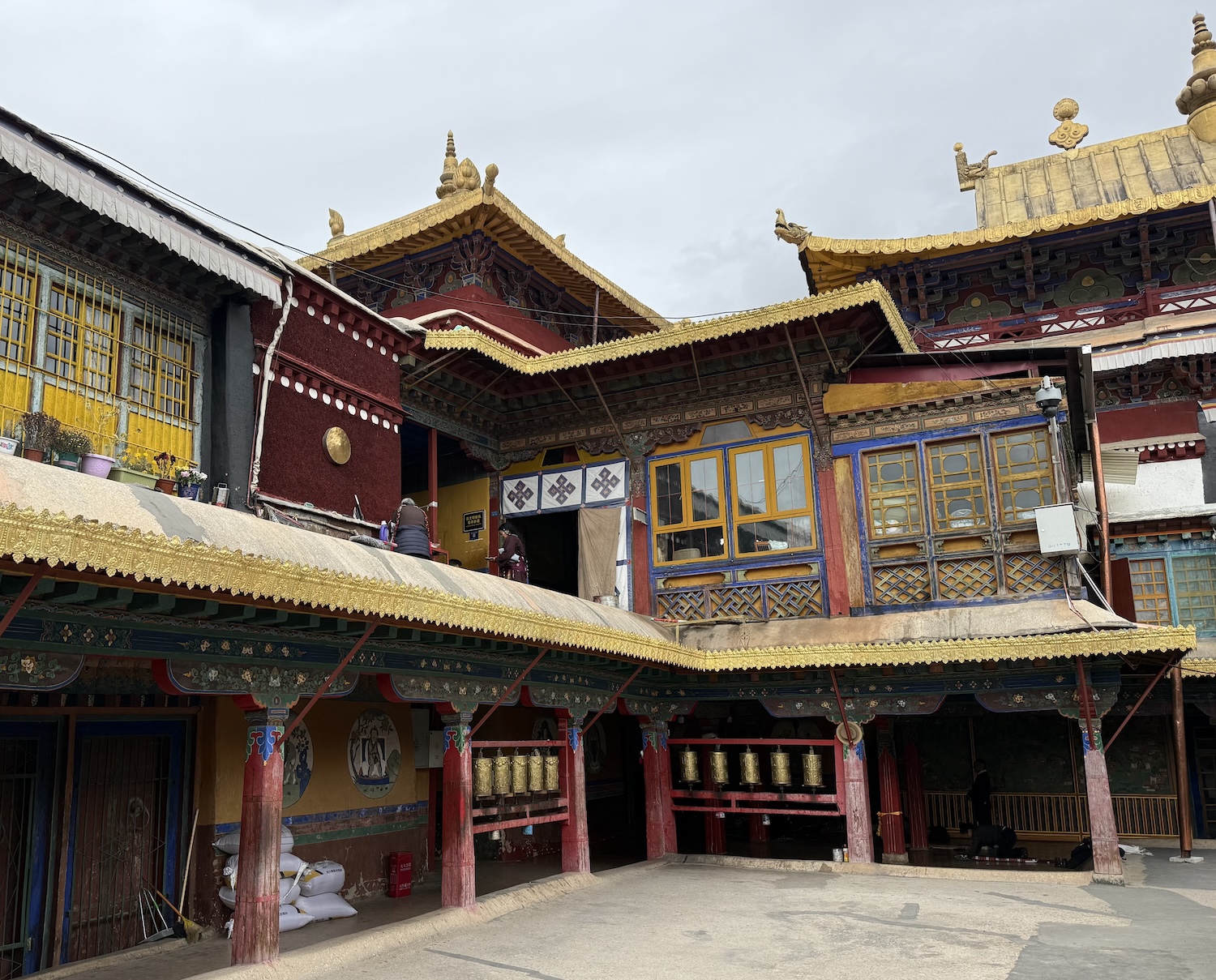
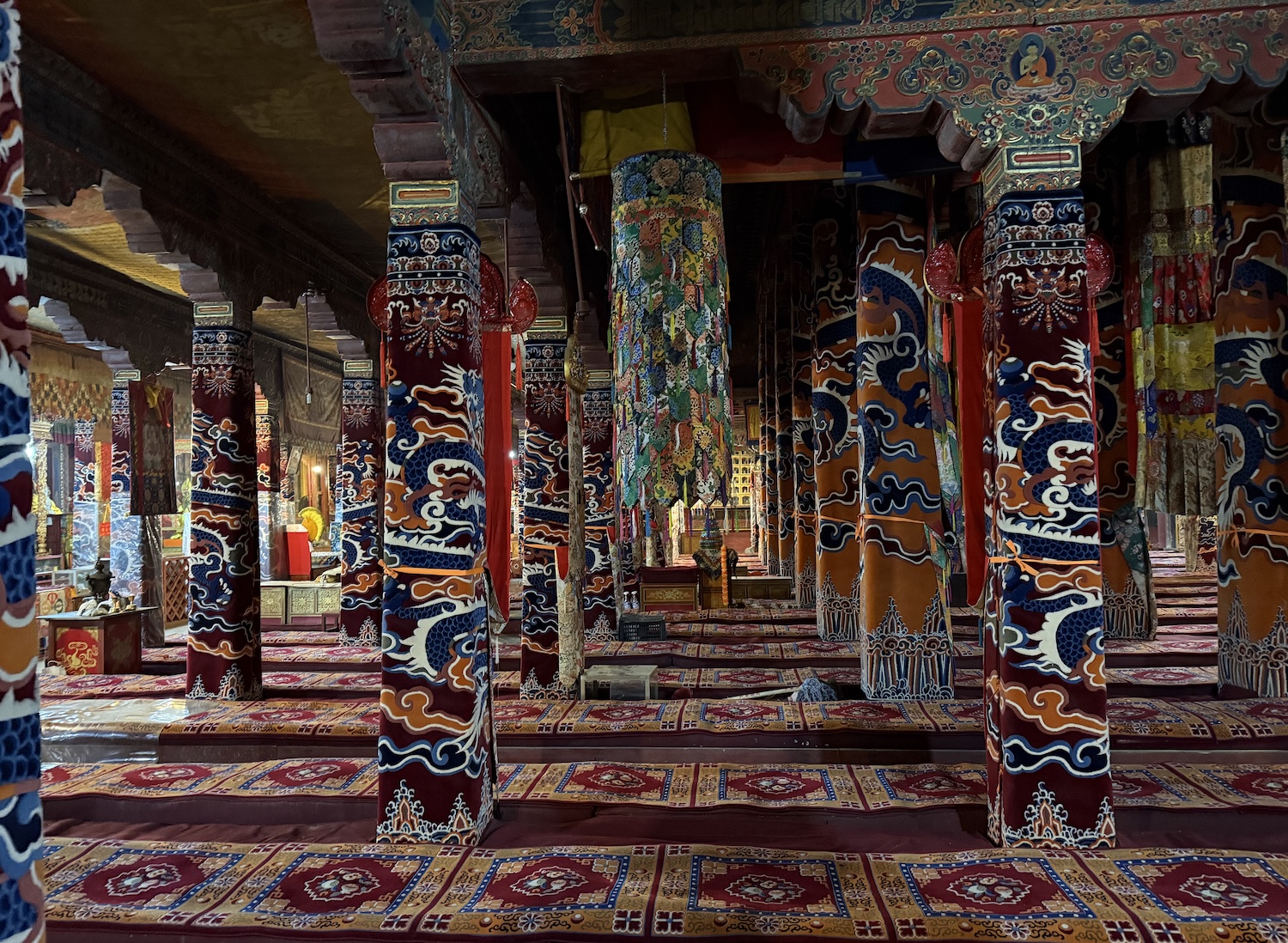
Dalai Lamas one to four all lived here, though the first two did not know at the time they were Dalai Lamas as they were not conferred until posthumously, in 1578. Their tombs are in the Main Assembly Hall. Drepung also has an excellent on-site tea house, popular with its monks.
About 8km northeast of Potala Palace is Sera Monastery, another enormous Gelugpa shrine, built just three years after Drepung, and most of what we see here in this maze of chapels is original. It is particularly known for sanctifying children, so we see many parents, of a generation much younger than are usually found in these temples, carrying their toddlers to receive blessings. It also has a series of superb workshops where amulets and effigies are carved and painted, which can be bought by pilgrims, and by tourists hunting authentic souvenirs.
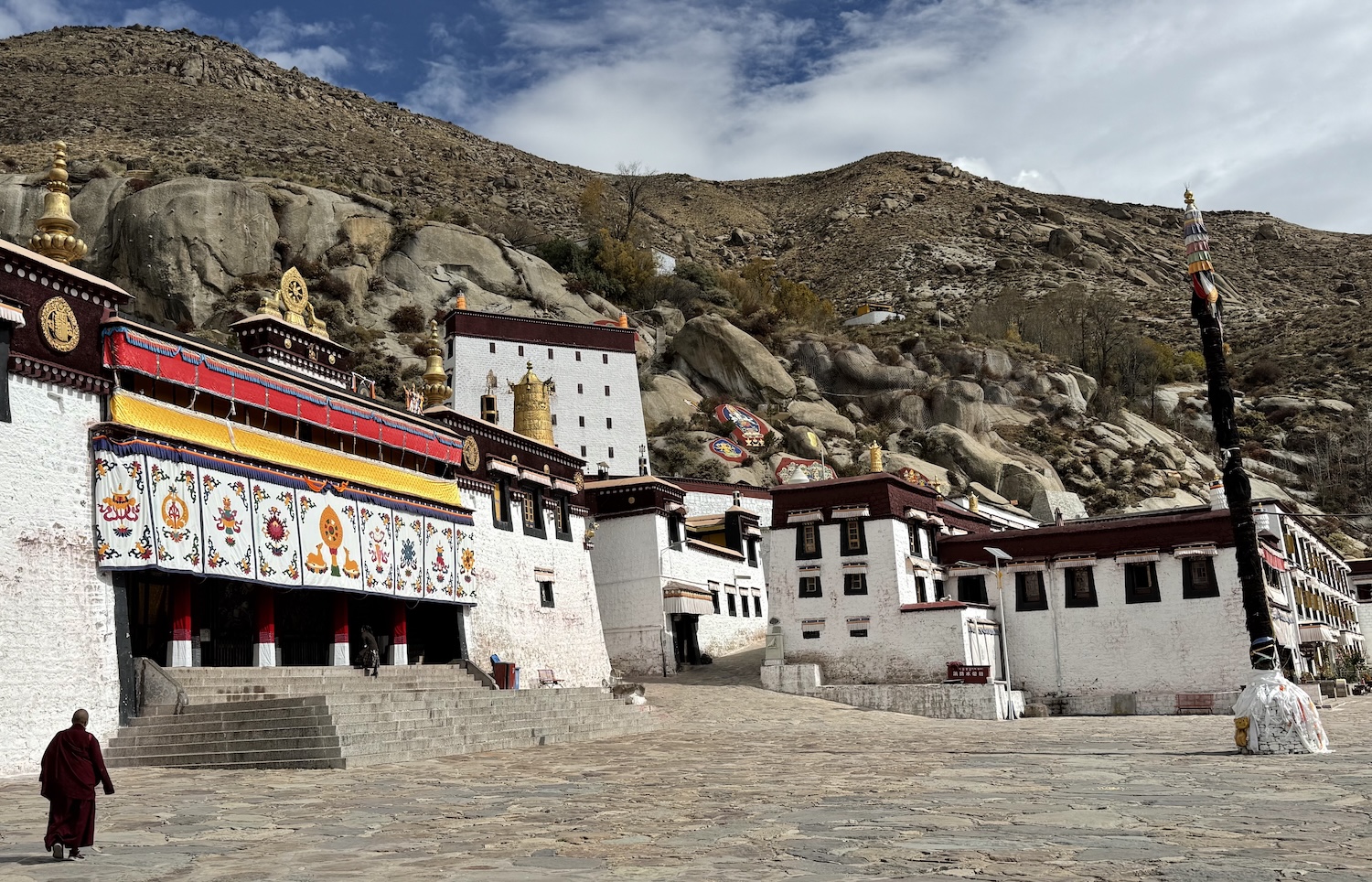
Sera is especially popular among tourists, largely because of the extraordinary debates between lamas that we are allowed to witness. These kinds of debates occur in all the major temples, though at random times, whereas at Sera they happen from three to five in the afternoon every Monday to Saturday. At least a hundred monks congregate on a lawn and tussle in pairs over philosophical issues in exaggerated animation.
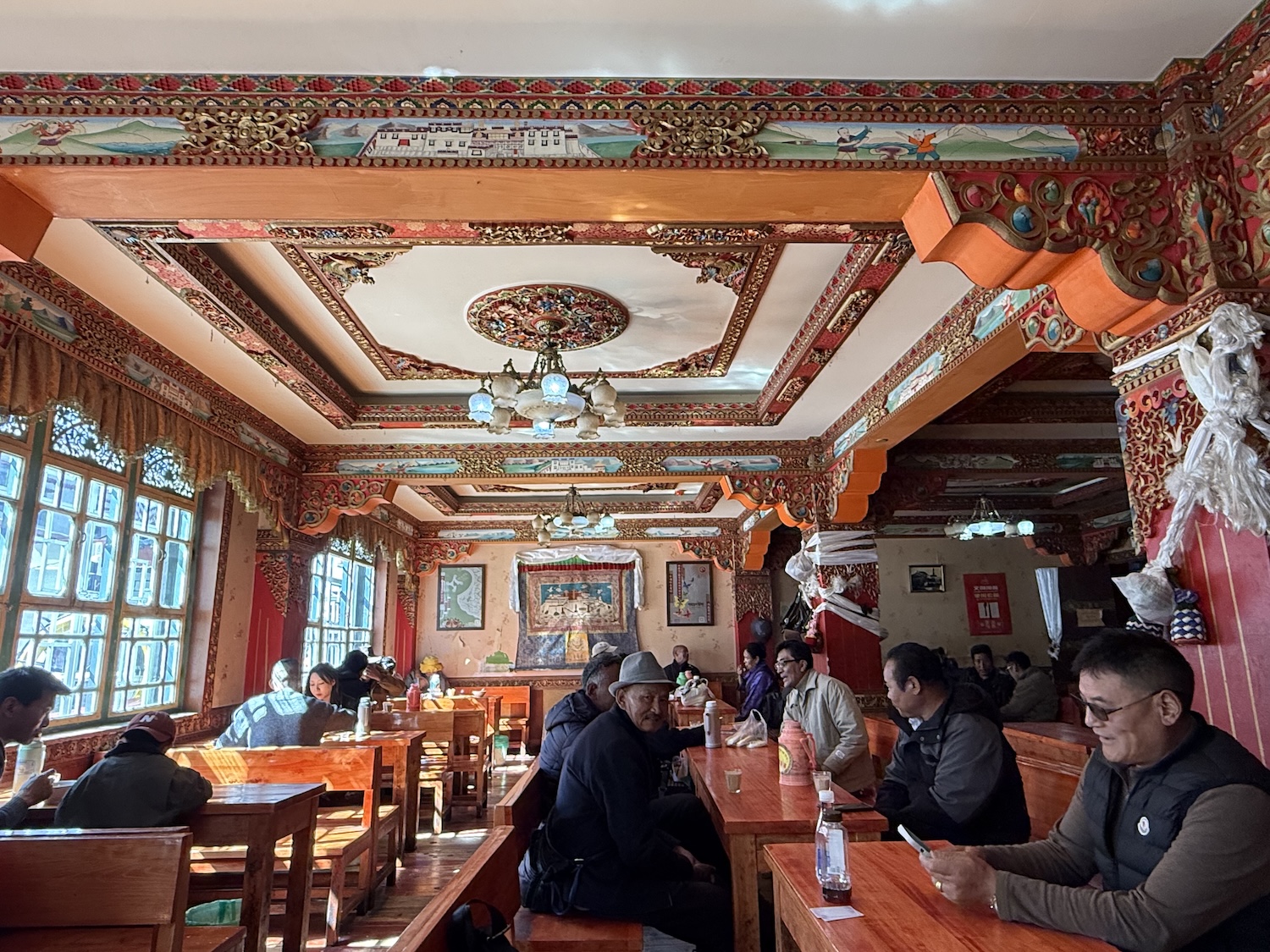
Lhasa is not renowned for its social life beyond the temples, though its tea houses are vibrant. In addition to beverages, they sell food staples such as noodle soup and momo dumplings. To get the archetypical experience, try Guang Ming Shang Dian Can Guan in the Old Town. There are of course lots of tourist trap restaurants in the Old Town too, the better ones being Lhasa Kitchen and Tibetan Family Kitchen, but for something better, try Dunya on Beijing East Road. Not far from here is Bakuo Bar Street, which does what it says on the tin.
For older people, popular activities are mass tai chi and synchronised dancing. The place to witness them is Dzongyab Lukhang Park early in the morning, when it is filled with energy.
Lhasa has some inexpensive versions of international five-star chain hotels, including the St Regis and the Shangri-La. They have humidifiers and pumps for additional oxygen in each bedroom, as well as communal oxygen lounges. In addition, there are of course some highly recommended Tibetan boutiques with a unique local cultural vibe, including the House of Shambhala, which is actually in Barkhor Street. Like many other local hotels, it can be booked only through a guide or on the major global platforms such as booking.com and trip.com.
Before we leave Lhasa, there are two significant monasteries out of town that can be seen together in a day trip.
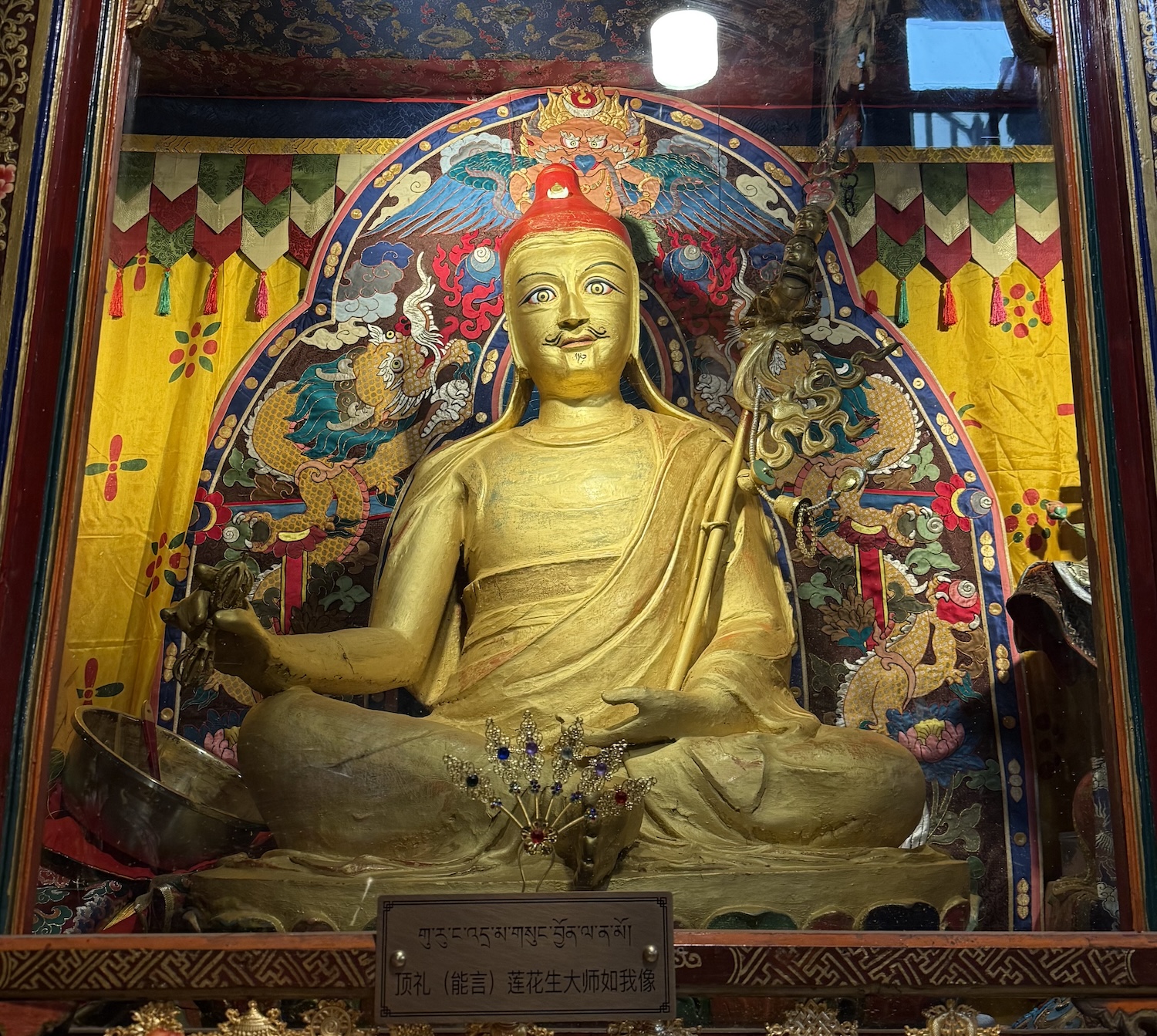
Samye Monastery is at the foot of Mount Hepo Ri, 120km southeast of Lhasa. This Red Hat shrine was the first Buddhist monastery in Tibet, built in the late eighth century when Trisong Detsen – the second of the three so-called dharma or religious kings – invited the Indian Master Guru Rinpoche and the Indian Abbot Shantarakshita to oversee it. Many of its deities have coverings over their faces, a practice that dates back to when these early Buddhists had to worship in secret to avoid the wrath of the ruling Bonists.
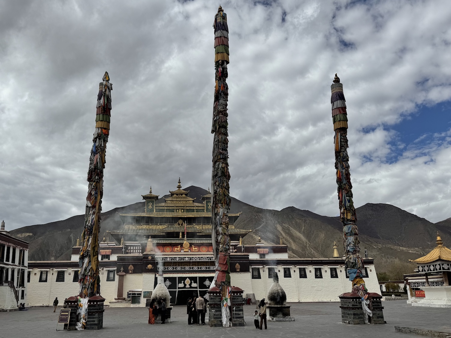
Samye is relatively small, located in a single building of three floors: it is in Tibetan style on the first floor, Chinese on the second, and Indian on the third. The temple is devoted to Guru Rinpoche, the man who is revered for bringing Buddhism from India in the eighth century. His effigy is found in most Buddhist temples in Tibet, usually with big, round and staring eyes, though nowhere has quite as many of him as here. Although the temple was of course destroyed in the 1960s, and has been rebuilt only in the past decade, a statue of him dating back 1,300 years was saved and is the centrepiece of the Tibetan floor, the oldest surviving image of him in Tibet. There is also an eighth century figure of Buddha, though the head of the original was damaged and had to be replaced recently.
Ganden Monastery is beautifully situated at the top of Mount Wangbur, overlooking Kyi Chu Valley, 70km west of Lhasa. It is immediately imposing, almost like Potala Palace. There is a short walk along the road from the car park that gives stunning views in all directions.
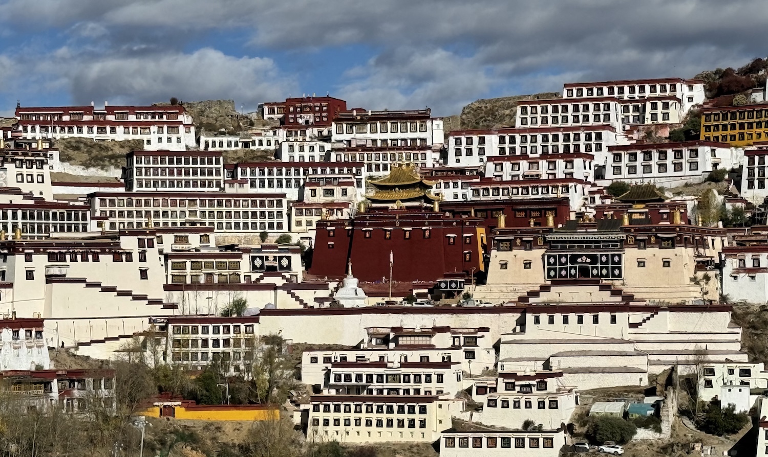
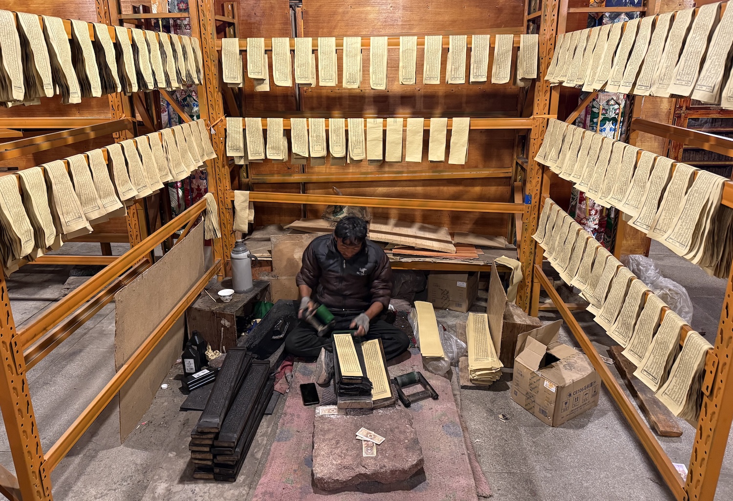
Built in 1409, this was the first Gelugpa monastery and therefore has a pivotal place in the rise of the Yellow Hats and the story of Tibet over the past seven centuries. The founder, and central icon in the shrine, is Tsongkapa, a yogi considered the spiritual father of the Dalai Lama lineage. The large white building, the Main Assembly Hall, contains his throne, while the big red building, a chapel, has his tomb. The original buildings were destroyed in the 1960s and have been rebuilt over the past five years, and indeed are still being rebuilt inside and out, though the throne is 700 years-old and the tomb is largely intact from 1420, though some of its jewels of jade and turquoise were stolen. Like most of these temples, Ganden has a massive library, though here there is also an on-site printer where the scripture books are copied in the ancient handmade fashion.
Namtso
There are more than a thousand lakes in Tibet, but there are three that are decreed Holy to local people who believe they are the homes of deities. These are Manasarovar, at the foot of Mount Kailash, Yamdrok, which we will visit on the road from Lhasa to Gyantse, and Namtso, 240km northwest of Lhasa.
As Namtso is not on the Lhasa-Everest route, it is rarely included on the standard itineraries. Yet the beauty of the journey here, and of the water itself, demands at least a day trip from the capital. For starters, we drive through the stunning snow-capped mountains of the Nyenchen Tanglha range.
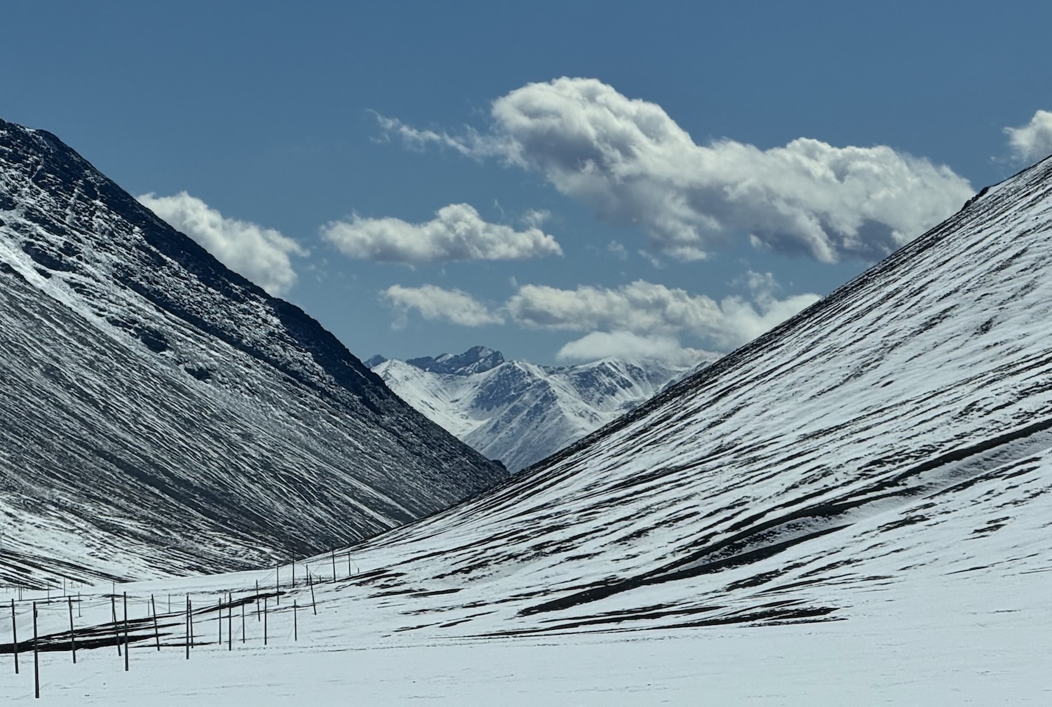
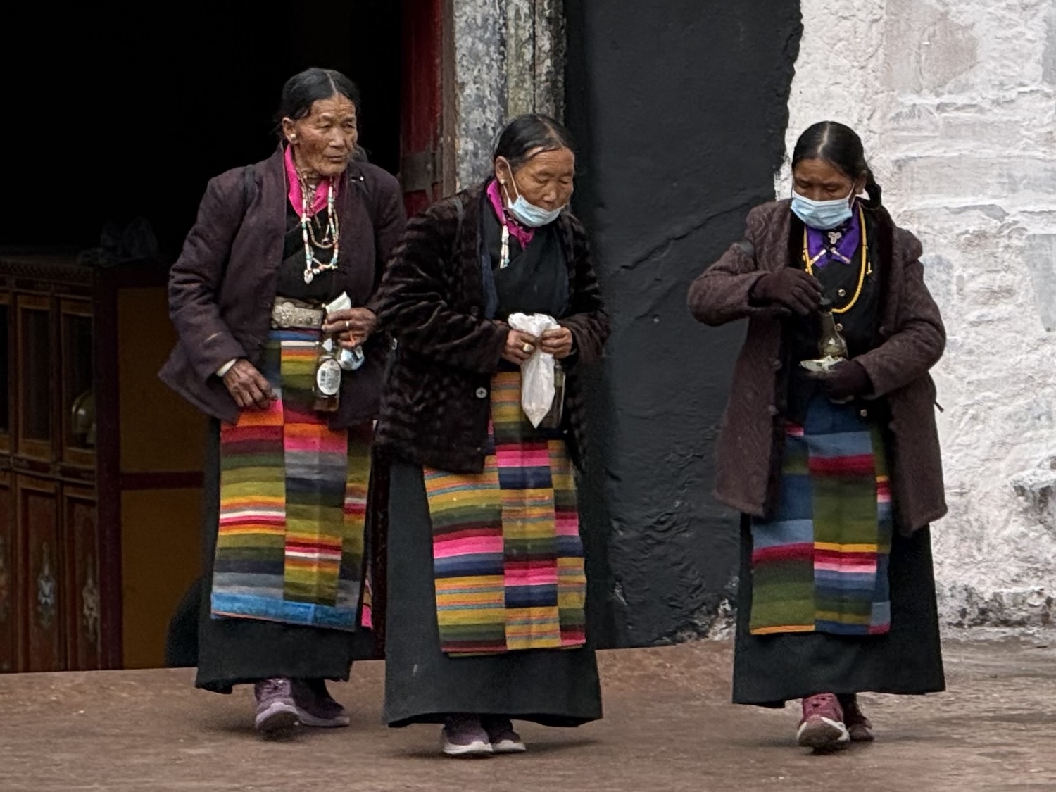
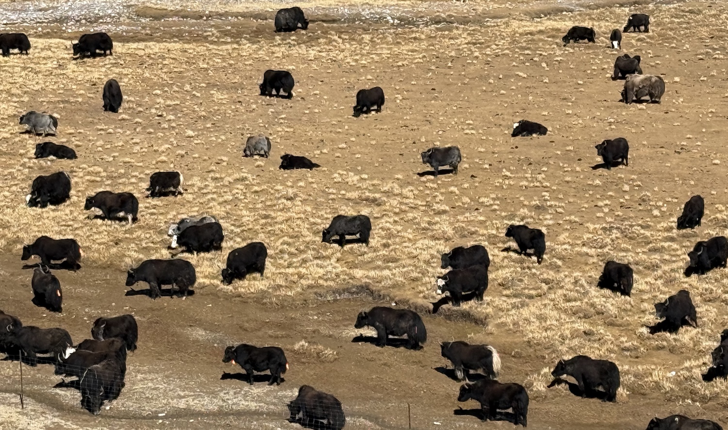
For more than three hours we then see little but barren plains that look almost like desert, with little but wandering horses, sheep and yaks, the livestock of nomadic farmers. There are also a few yurts, but at this time of the year they have been abandoned until the summer comes around again. Unlike across Central Asia, most former nomads here are now housed in state-funded permanent accommodation, though villagers do still wear traditional chuba robes and felt hats for men, and pangden striped aprons for women, in colours and patterns unique to their region.
We have to wait at Namtso Gate for a while, along with lorries on their way to Mount Kailash, because the road through 5,190m-high Lagenla Pass had been closed for a few days because of heavy snow. These kinds of weather-related disruptions are hardly unknown in Tibet, and eventually we are allowed through.
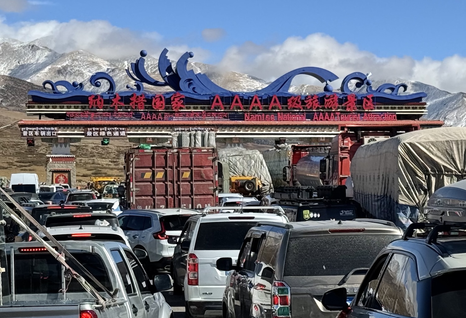
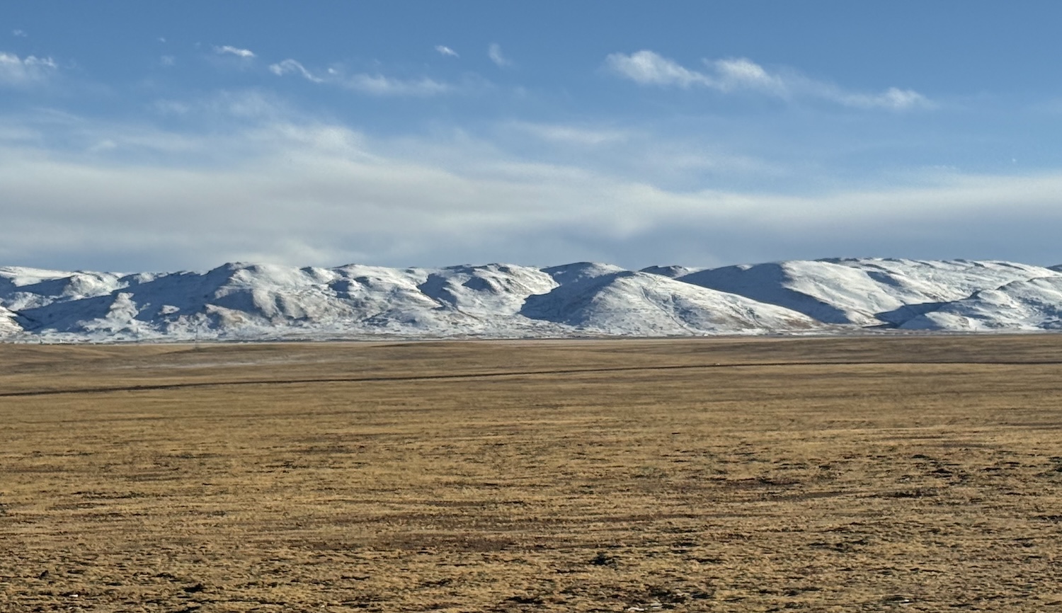
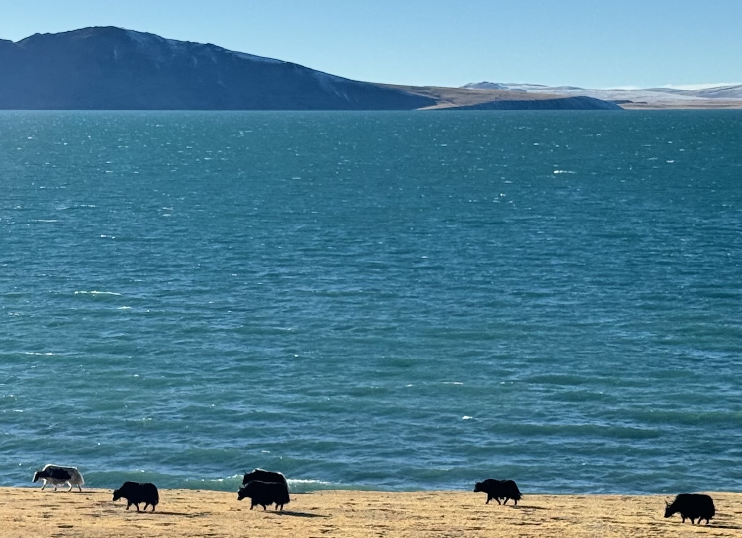
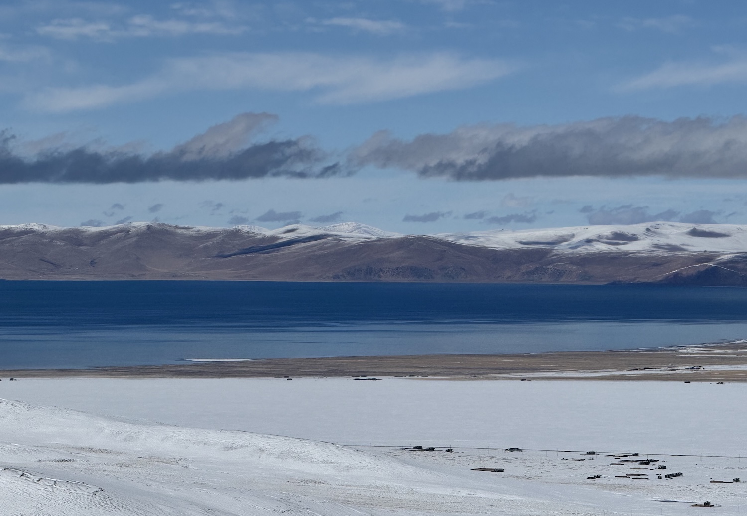
For the next half-an-hour, we drive through the boundless Qiangtang Grassland, though in October it is all blanketed in snow. Finally, we see part of the bright blue lake, 4,718m above the sea, with a circumference of 320km, bordered by white-topped mountains under the lightest sprinkling of wispy clouds. At the small town of Damxung, tourists have to switch into a national park eco-bus for a thirty-minute ride to the water’s edge.
Yamdrok
The tourist drive from Lhasa towards Shigatse is usually on coaches or 9-seat minibuses, even for just the two of us. They are fitted with emergency oxygen tanks, and as we climb higher many visitors use their own portable versions. The tarmac has been laid in the past decade or so, and goes through villages lined with Chinese flags and massive portraits of President Xi. There are occasional security checkpoints, but nothing heavy at all, usually requiring little more than a walk through a pavilion so the CCTV can capture our mugshots, though sometimes our guide also has to show our passport and permit.
There are tourist sights every hour or two, mostly at magnificent temples and spectacular mountain passes, as well as a possible overnight stop. Therefore, it feels manageable, even though it is a total of 260km from Lhasa to Shigatse that driven straight would take about six hours. Essential items to pack for this journey are water bottles and lip balm.
We set off down the valley of the Yarlung Zangbo River, which goes all the way to Bangladesh. Around here, it runs through brown rocky hills. In days of yore, local people would chop up their dead and dump them in the river to decay. These days, that is out of fashion with the authorities, so instead they tend to leave the corpses in the hills to be eaten by vultures, known as Sky Burials.
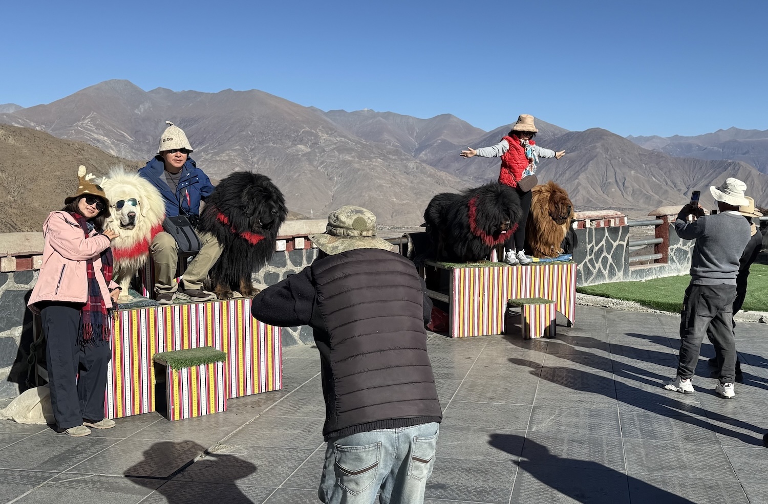
Along the way there are several spots where cuddly Tibetan Mastiffs can be found. These dogs grow up to 70kg and were employed in bygone times to protect monasteries from bears, wolves and snow leopards. Nowadays, they are dressed in necklaces and sunglasses by owners selling selfies to tourists, and Chinese coach parties are more than happy to oblige.
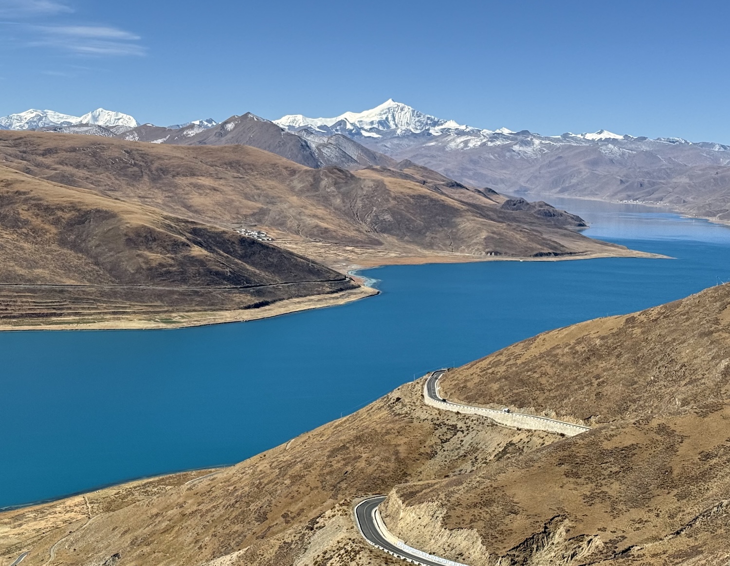
Yamdrok, another of the Three Holy Lakes of Tibet, is about 100km southwest of Lhasa on Highway 307. It is about half the size of Namtso, with a perimeter of 150km, but it is also turquoise and gorgeous. Mastiffs and yaks at the shoreline are again touted for photos, and on the horizon is permanently snow-capped 7,191m-high Mount Na Chen Kha Sang.
The best view of Yamdrok Lake is at Kamba La Pass, which is at 4,998m, and is therefore usually crowded. While we were there, one enterprising young soul parked their jeep in front of the view and charged people to stand on its roof, not to get a better look, but so they could have their video taken while singing along to booming music. Only the Chinese!
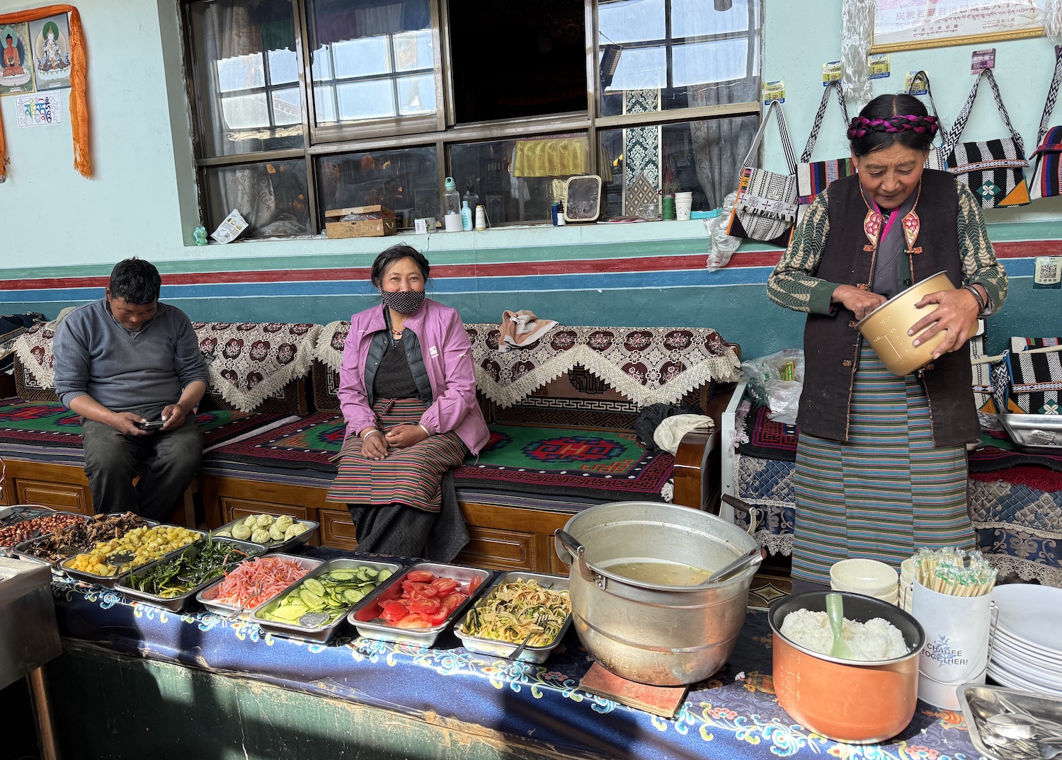
It is common to break here for lunch at a family home beside the lake. They tend to be professional affairs with numerous tourists passing through for butter tea, yak cheese, a buffet of many types of meat and veg, with barley bread and barley wine.
Mount Na Chen Kha Sang is part of the Nyenchen Tanglha mountain range, which we head through as the landscape gradually turns from brown to white. We see several imposing glaciers, though we are told they are shrinking because of the climate crisis.
The big star is Karula Glacier, which peaks at 5,560m. At the foot is a small chedi that is a popular spot to tie colourful prayer flags. You do get these in Lhasa and the cities, but they are much more common in the countryside, not least because they look best fluttering in the rasping wind. They are bought from assertive vendors and are supposed to bring good luck.
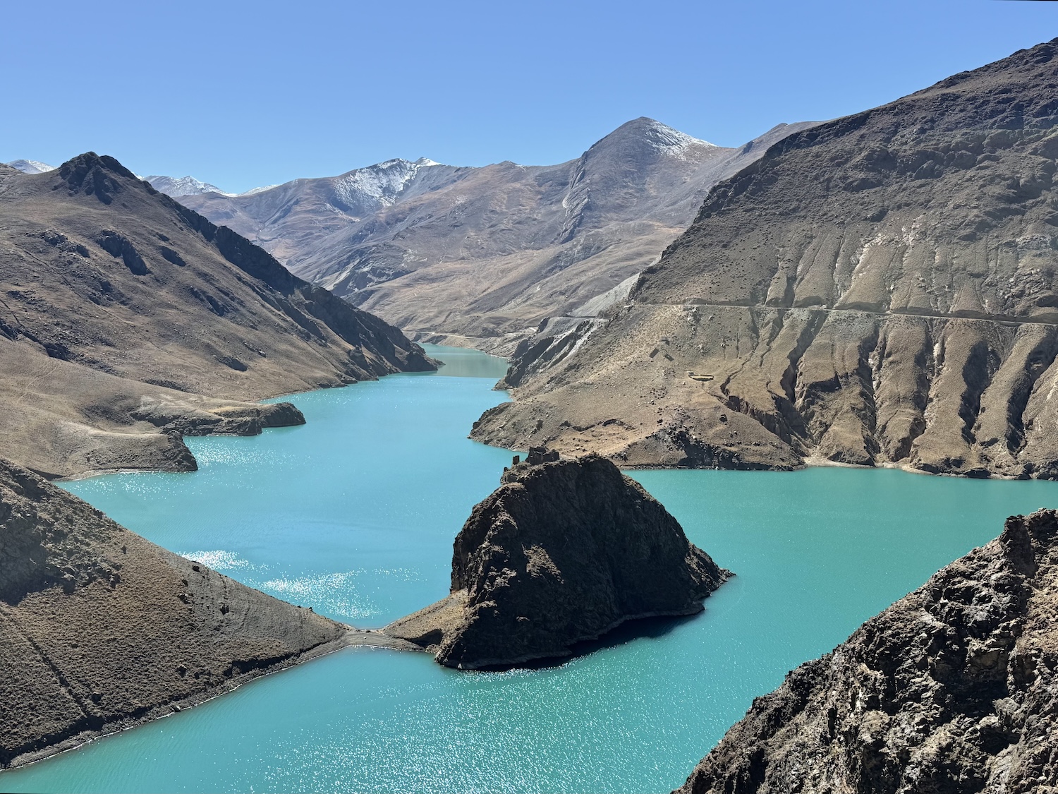
There is an excellent view from Simila Mountain Pass, at 4,352m, of Manla Reservoir, created by a dam built in 2000, which again has a gorgeous turquoise sheen.
Gyantse
Gyantse is a pretty little town 260km, a five-hour straight drive on Highway 307 from Lhasa. It used to be the standard sleep stop for tour groups, but that is less common now the roads have improved so drivers prefer to get all the way to Shigatse in one day. However, its castle is historic, its monastery impressive, and its Old Town lovely, sufficient to warrant a night and take the journey at a more leisurely pace. The best places to stay are the Gyantse Hotel and the Jiangzi Nyangchu Manor House.
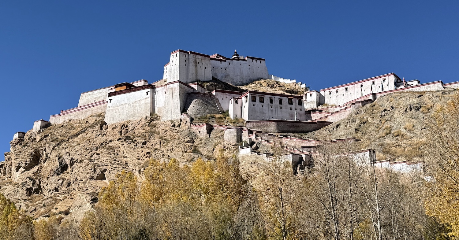
Dzong Castle has towered over the town from the top of a rocky ridge since the ninth century, with significant expansions in 1268 and 1365. In 1904, it was the scene of a major battle, an ultimately doomed attempt to resist British expansion in the region, which caused many fighters to jump to their deaths rather than surrender. It was destroyed in the 1960s, though in the past decade it has been rebuilt in impressive style.
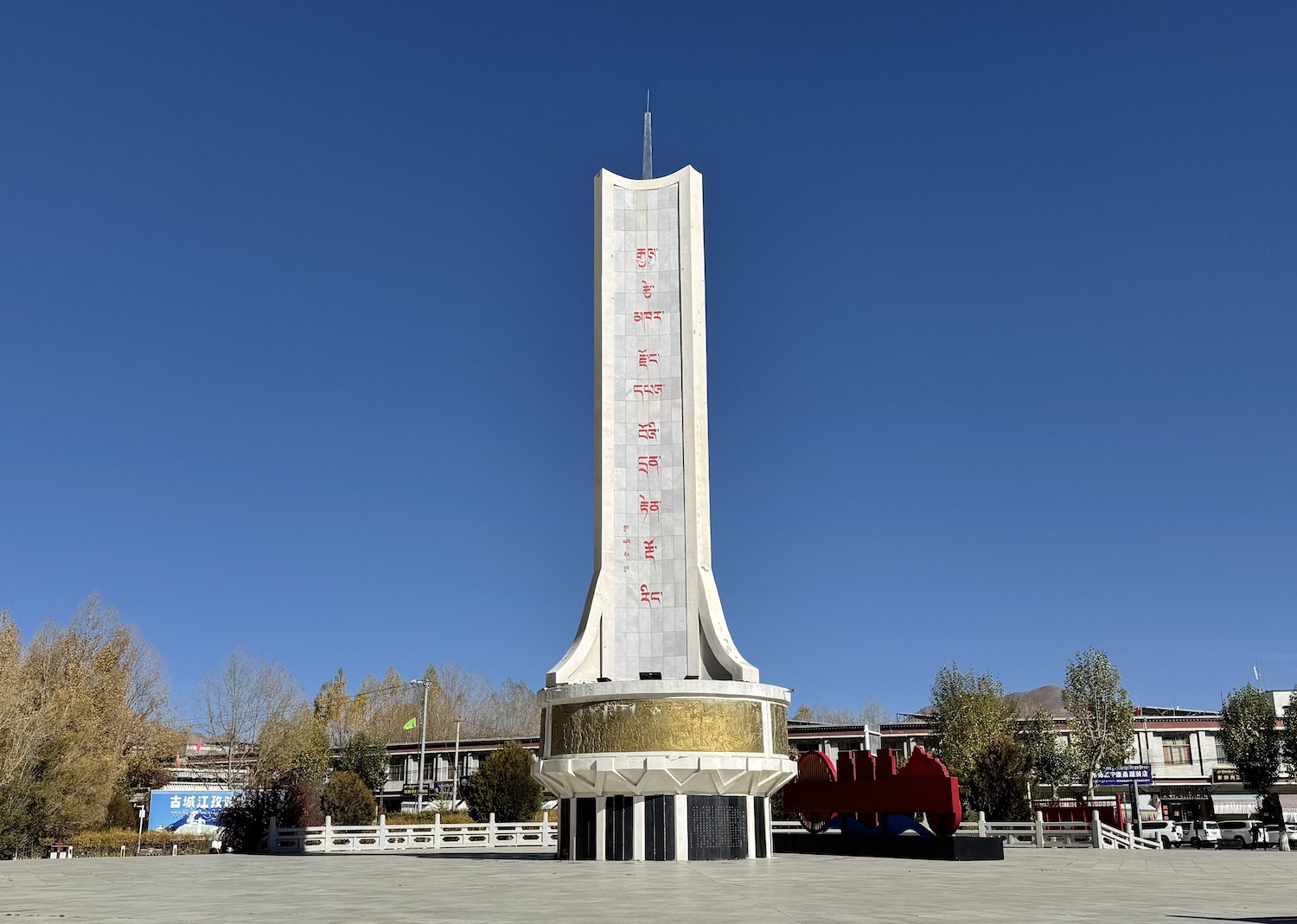
Opposite is a monument to the Chinese effort at beating back the British in 1904. Although there seems to be some scepticism about this reading of history, it is clearly designed to show the Tibetans that the Chinese were on their side all along.
Kumbum Monastery is a highly prized architectural masterpiece, not least because its buildings, murals and stuccowork are more or less original, dating from the 1430s. Some parts were destroyed but most remained intact because it was so well protected by its monks and its villagers. Although it was originally a Gelugpa shrine, unusually it now houses Sakya traditions too.
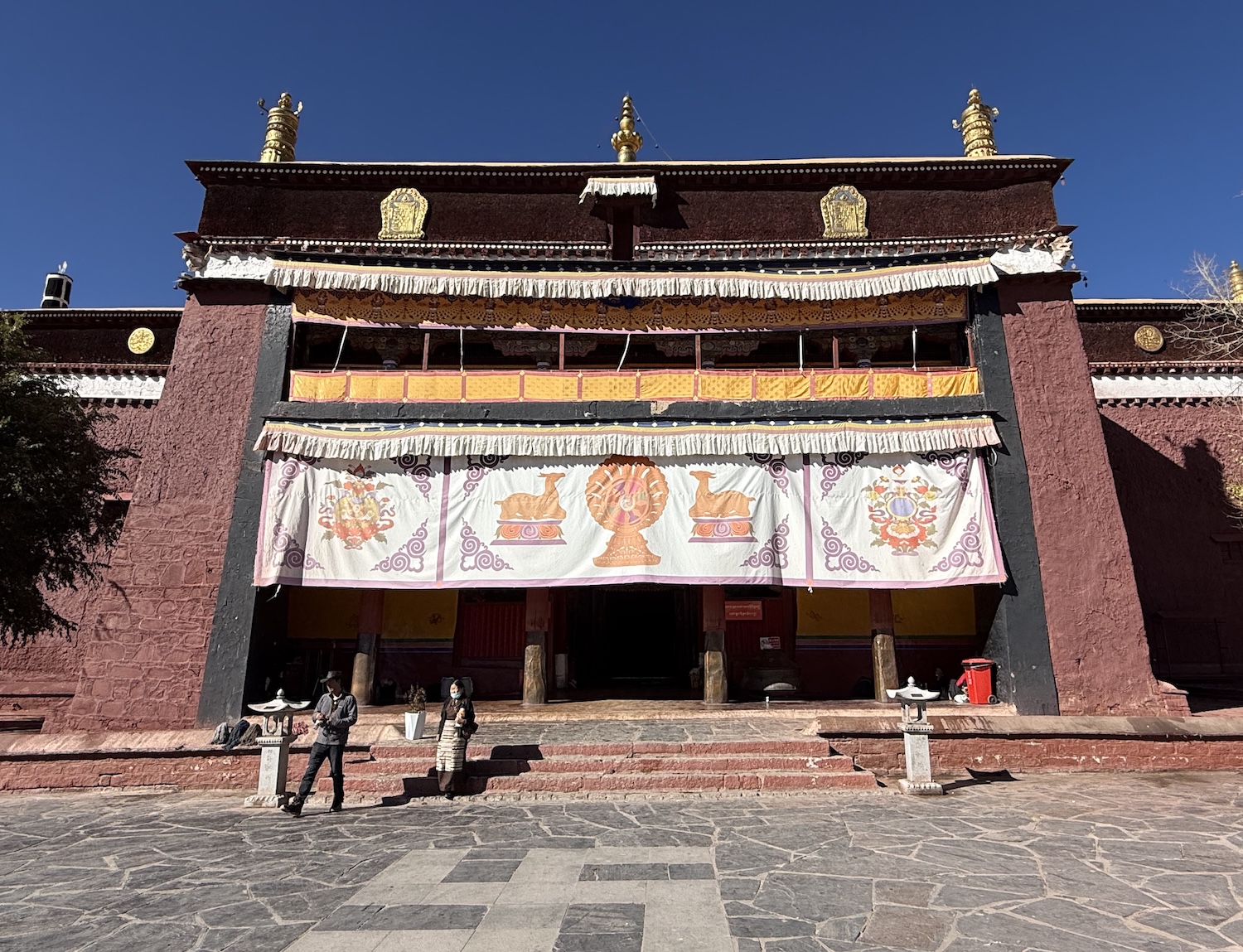
Kumbum means a hundred thousand images, and this cannot be far from the truth as there is a massive collection of statues and effigies in its seventy individual chapels. The highlight is a row of three original bronze Buddhas that were saved from destruction because they were hidden behind bags of barley piled from floor to ceiling that made the chapel look like a simple storage room; barley is grown all around Gyantse, and we pass through fields and fields of it for miles and miles. We are of course rarely allowed to take photos inside important shrines, but sometimes people do sneak them when they think nobody is looking, despite the preponderance of CCTV cameras.
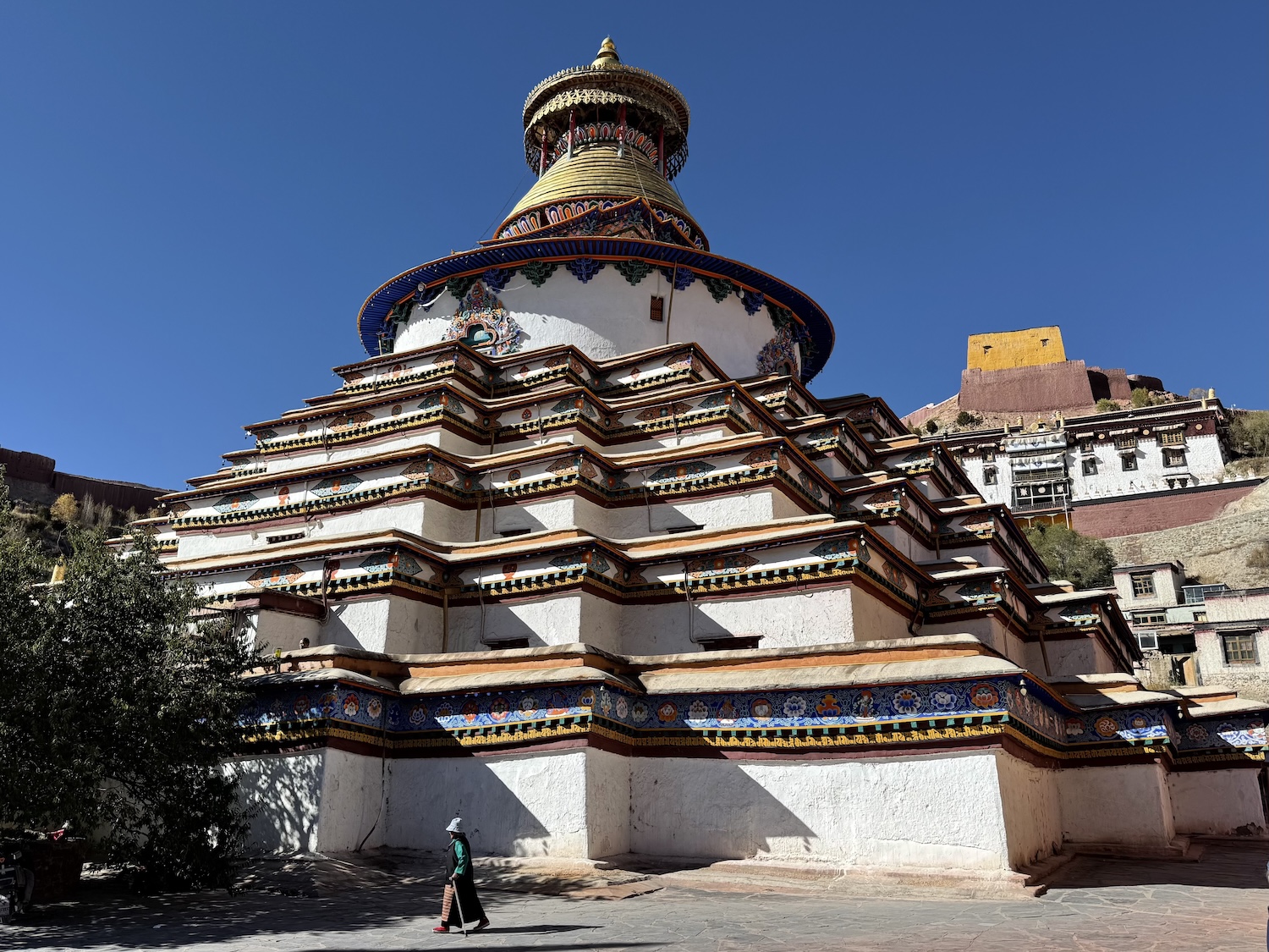
Three major parts of the monastery have been recently and sympathetically rebuilt. The most important of these is the nine-tiered Pelkor Stupa, which you can climb for great views over the Old Town to Dzong Castle.
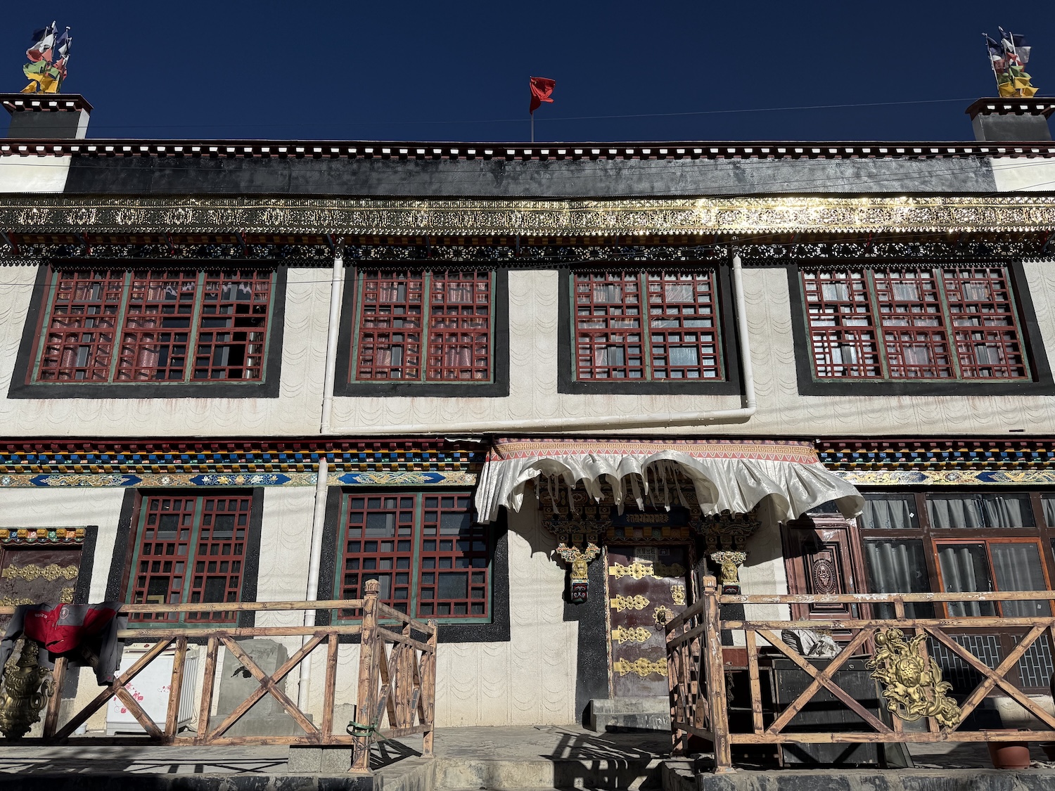
The Old Town is cute, a mini version of Barkhor Street in Lhasa. Its recently restored streets, displaying intricate lattice windows through red and white walls, deserve more than just a drive-through to reach the monastery.
Shigatse
Shigatse, the second city of Tibet, with a population of about 800,000, is roughly 270km west of Lhasa, less than 100km on from Gyantse on Highway 318.
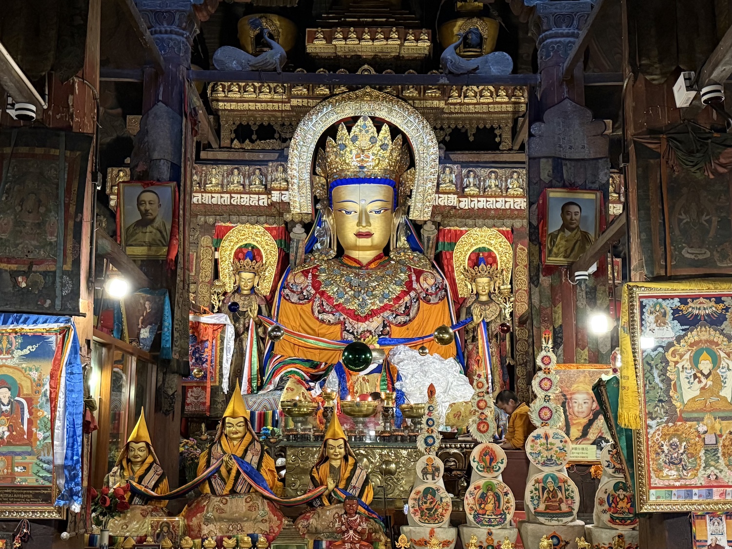
Bang smack in the centre of the city is the principal reason pilgrims and tourists flock here in large numbers: Tashilhunpo Monastery. This is the biggest monastery in Tibet, like a city behind walls, and about a third of it is original, dating back to 1447. It was founded by Gedhun Drub, who was retrospectively named the first Dalai Lama having been a disciple of Tsongkapa, the progenitor of the Yellow Hats. Even today, almost a thousand monks work here. At its heart is the world’s largest gilded bronze statue of the Maitreya, or Future Buddha, a legendary icon of Buddhism, created in 1914.
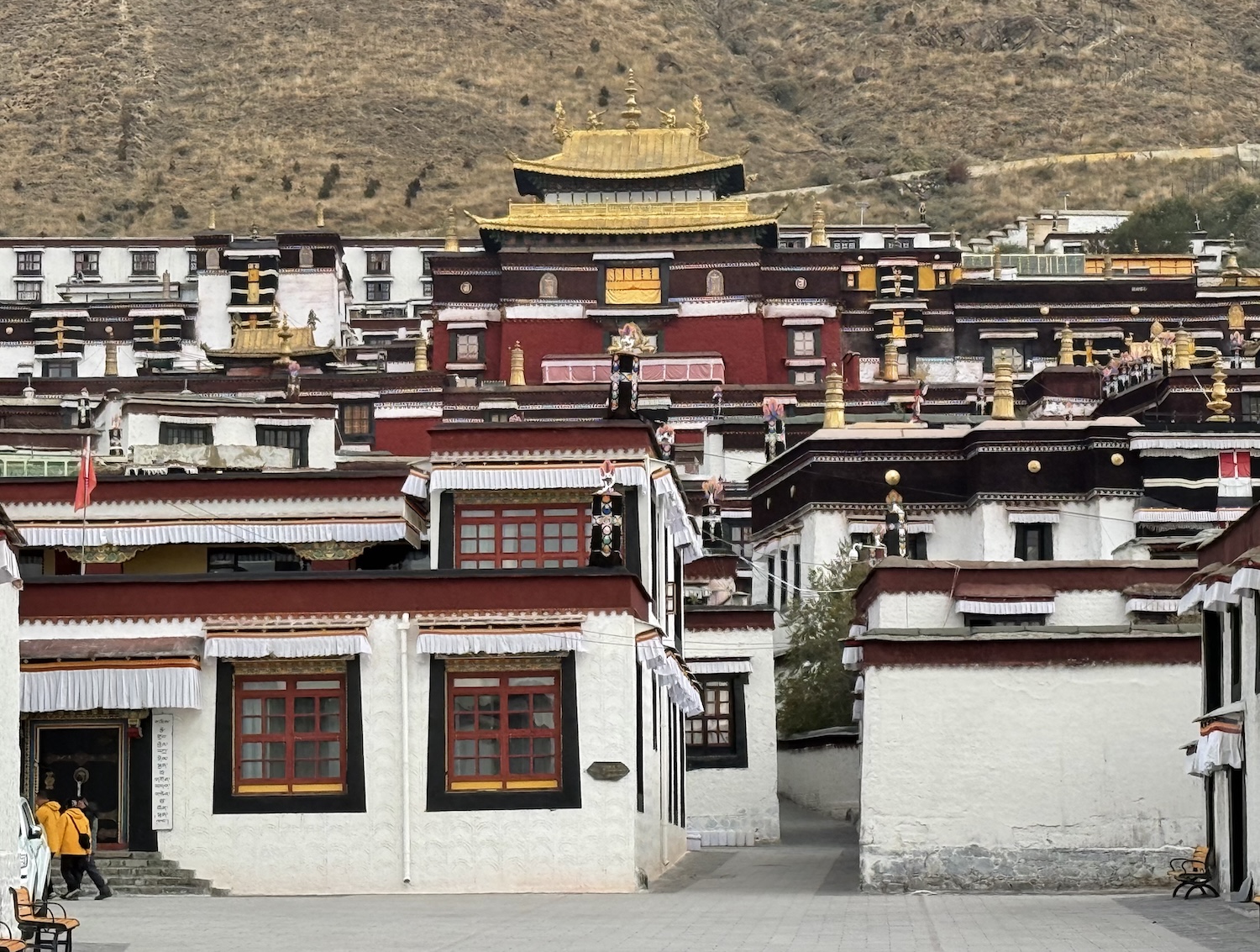
Tashilhunpo is the ancient seat of the Panchen Lama, who is effectively deputy to the Dalai Lama. The bodies of Panchen Lamas four and ten are entombed here, though in the 1960s the graves of five to nine were all opened and their remains burned, so their ashes are now all mingled together in a new stupa nearby. The eleventh and current Panchen Lama, Gyaincain Norbu, who is recognised by the Chinese Government, was enthroned here in 1995, though he resides in Beijing. He will have huge sway over the recognition of the next Dalai Lama, after the current 91-year-old dies, having reigned since 1940.
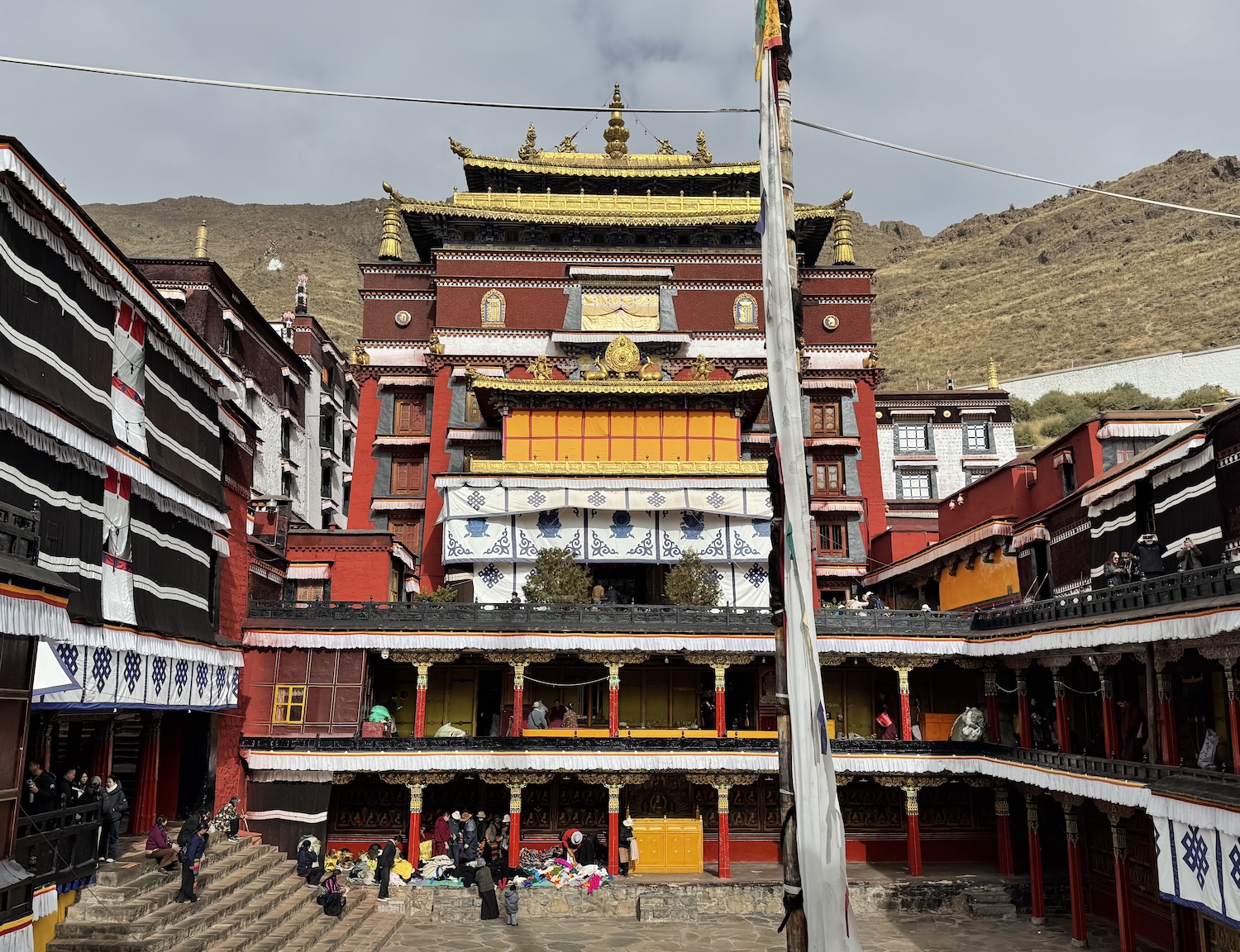
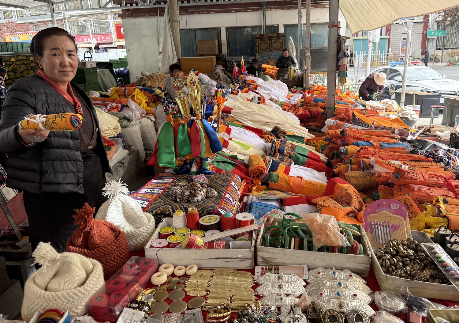
Local people come to Tashilhunpo to donate clothing, often of their deceased relatives. These items are then resold inside the monastery to pilgrims, though they are also extremely attractive to visitors seeking genuine mementos. We bought extravagant his and hers ceremonial fur hats.
There is a more conventional market, Samdruptse, not far from Tashilhunpo on Bangjaikong Lam. The Chinese tour parties do not seem to come here so it feels sadly barren, which is a shame as it is a terrific insight into local culture. It is just one alleyway, at the top of which are stalls hanging skinned sheep and goat bodies, while their severed heads loll on the ground beneath. Further down are vendors offering shoes, ornaments and jewellery used by lamas and devotees, as well as locally grown tea and tobacco leaves.
For those going to Everest, we will overnight in Shigatse on the way there and back to Lhasa. There is a modern Hilton and a heritage option at the Qomo Langzong. Both are near the Tashilhunpo Monastery in the centre of town.
Yungdrung Ling Monastery is about 90km east of Shigatse, well off the beaten track; in fact, our guide had never been here before. Although it is new, it is of huge significance to Bonists, and it is quite an adventure. When we arrived, the gate was bolted so we had to attract the attention of a security guard to let us in. He would not allow us to enter until we proved that Yungdrung is specifically mentioned on our Tibet Permit, so it cannot be visited on a whim. Once inside the gate, we found several of the shrines also shut, with telephone numbers stuck on the doors so we could ring monks to open up for us.
Bonists are mostly concentrated around Mount Kailash in Western Tibet, and this is recognised as their second most influential monastery, and it is their only shrine between Lhasa and Everest. It was founded 200 years ago, expanded a century later, and though it was destroyed in the 1960s it was rebuilt in 2023 on a large scale, in sympathetic style, and with some ancient features. It also has a huge portrait of the patron of the new monastery, President Xi.
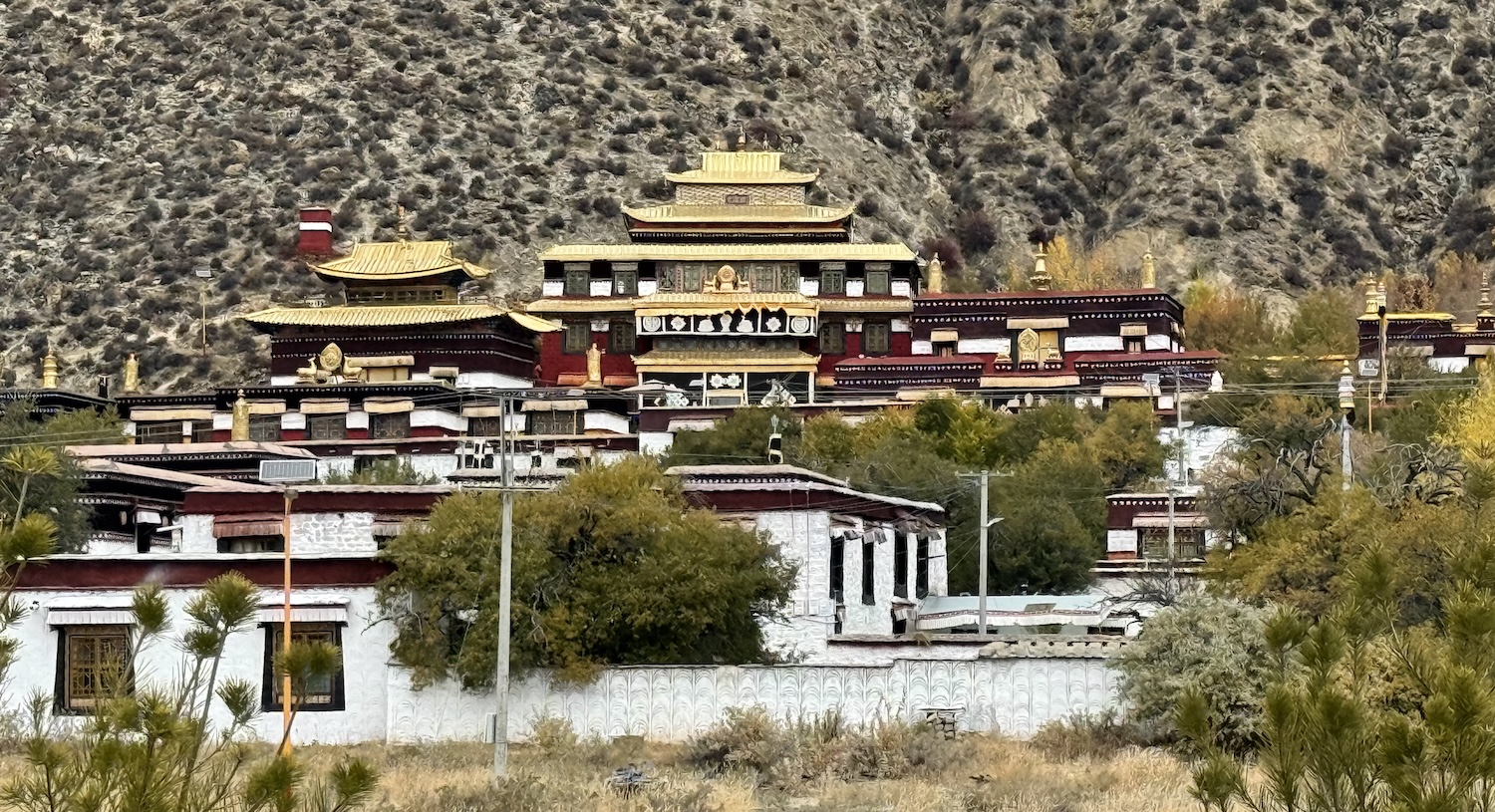
Yungdrung means swastika, which is one of the many symbols that Bonists brought to Tibetan Buddhism. They also brought the kora, though uniquely they walk in it an anticlockwise direction.
The lamas were keen to open a safe for us, where they keep the remaining original relics that were saved by locals who hid them at home. These include several human skulls of monks, which have been cut in half and upturned for use as receptacles called kapala to receive offerings from pilgrims of barley wine and yak butter. They also include bone parts of the founding Master, Nangton Lawa Gyeltsen, whose tomb is the central feature of the temple.
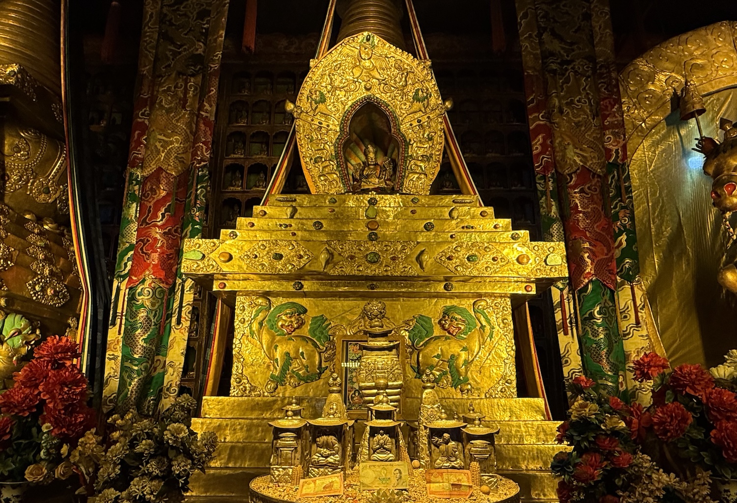
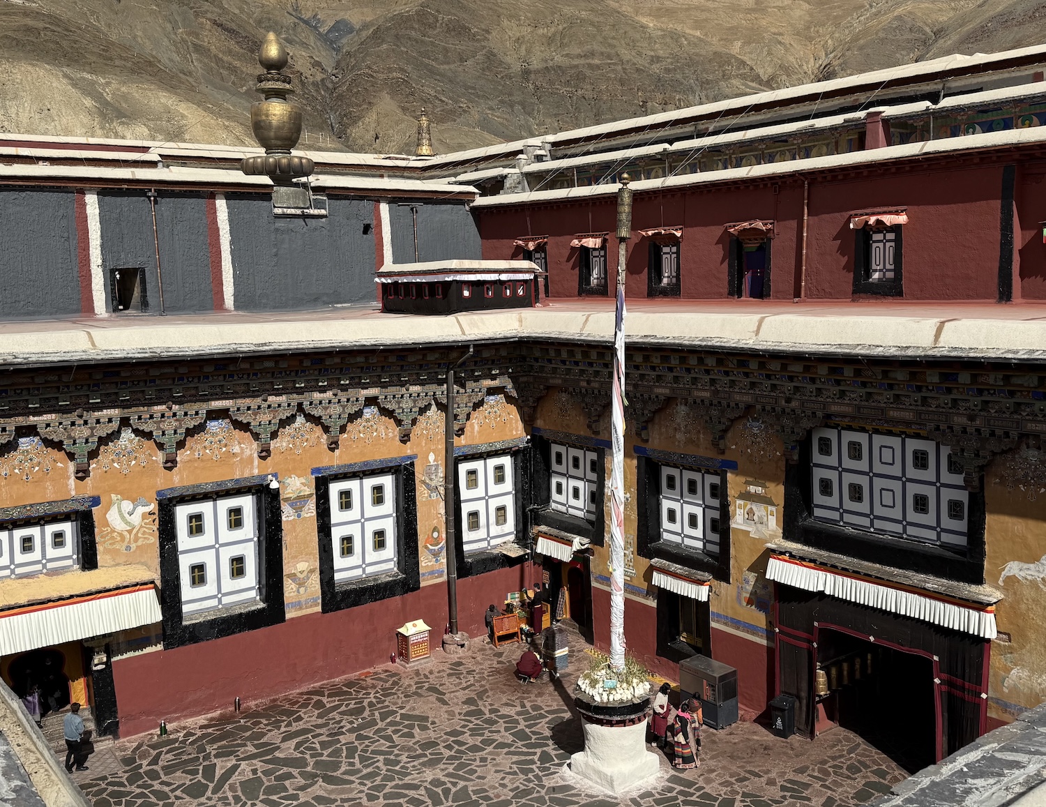
On a minor road 150km southeast of Shigatse is another rarely visited but important temple that is well worth the detour. This is in the town of Sakya, which was, obviously, the founding monastery of the Sakya School of Tibetan Buddhism, in 1073.
During the puppet Yuan Dynasty, Sakya’s monastic leaders served as Tibet’s political rulers, under ultimate Mongol patronage, from 1268 to 1354. These White Hats remain Tibetan Buddhism’s second largest faction, and they are the only School to allow their religious leaders to marry.
This is one of the few monasteries to come relatively unscathed through the 1960s, possibly because their ancient enmity with the Yellow Hats lent them a history of closer relations with Beijing.
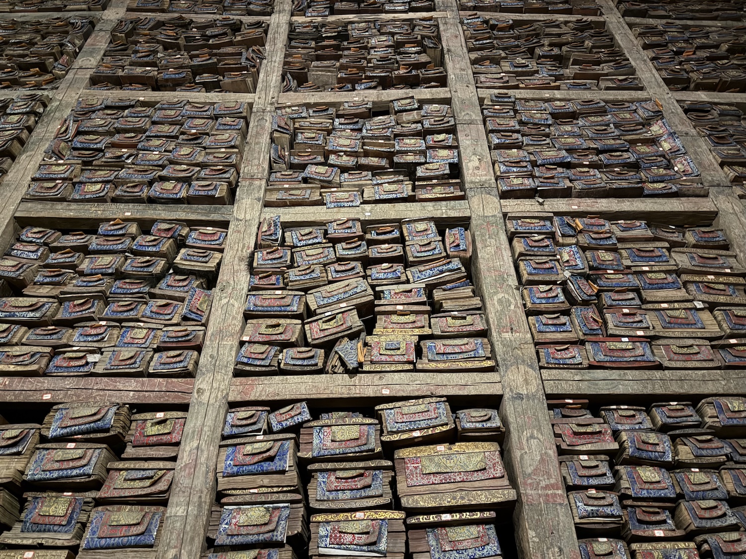
Sakya Monastery is famed for its Great Scripture Library, which holds up to 80,000 sacred texts, many on palm leaf manuscripts, or hand-copied in gold and silver. One weighs 500kg, the heaviest in the world.
That means we have visited one White and one Red Hat monastery, along with all the major Yellow Hat shrines, though there are so few Black Hat temples left, and none on the Lhasa-Everest route, that we will not see one of them.
Mount Everest
At 8,848.86m, Everest is not only the highest but surely also the most famous mountain on planet earth. Its peak is shared between Nepal and Tibet, where there is a Base Camp below the North Face, which is obviously one of the outstanding destinations in the world for the adventure traveller.
In simple signs of just three of the terrible difficulties climbers must face, most people are noticeably breathless by now from basic activities such as walking, the icy wind is biting on the face and hands, and it is essential to check the weather forecast before setting off for Base Camp. We came in October, when the chances of clear skies are greatest, though daytime temperatures hover around 3°C and nighttimes fall to -10°C (the annual average is -4°C, with winter lows reaching -20°C). However, cloud and snowfall were moving in quickly on the days we had scheduled, so we threw out our entire itinerary and charged down here as fast as we could to see the famous skyline against the deep blue sky.
Base Camp is 350km southwest of Shigatse, a 6-hour straight drive that takes a bit longer because of the viewpoints and passes through the Himalaya that are certain to delay us all.
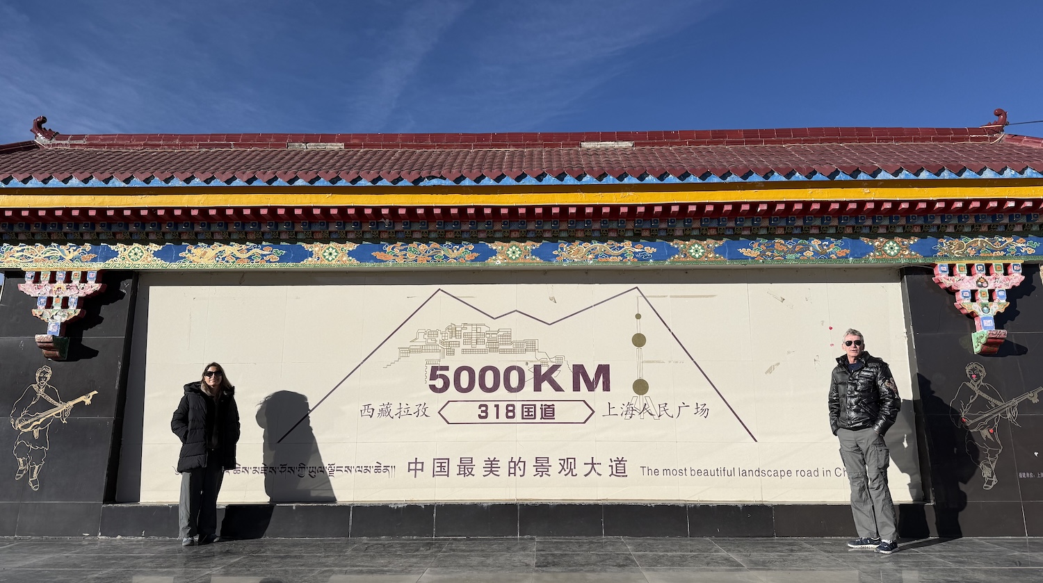
Straight out of the blocks is a marker showing it is 5,000km from Shanghai in the far east of China to here in the far west, an allegedly scenic journey along Highway 318.
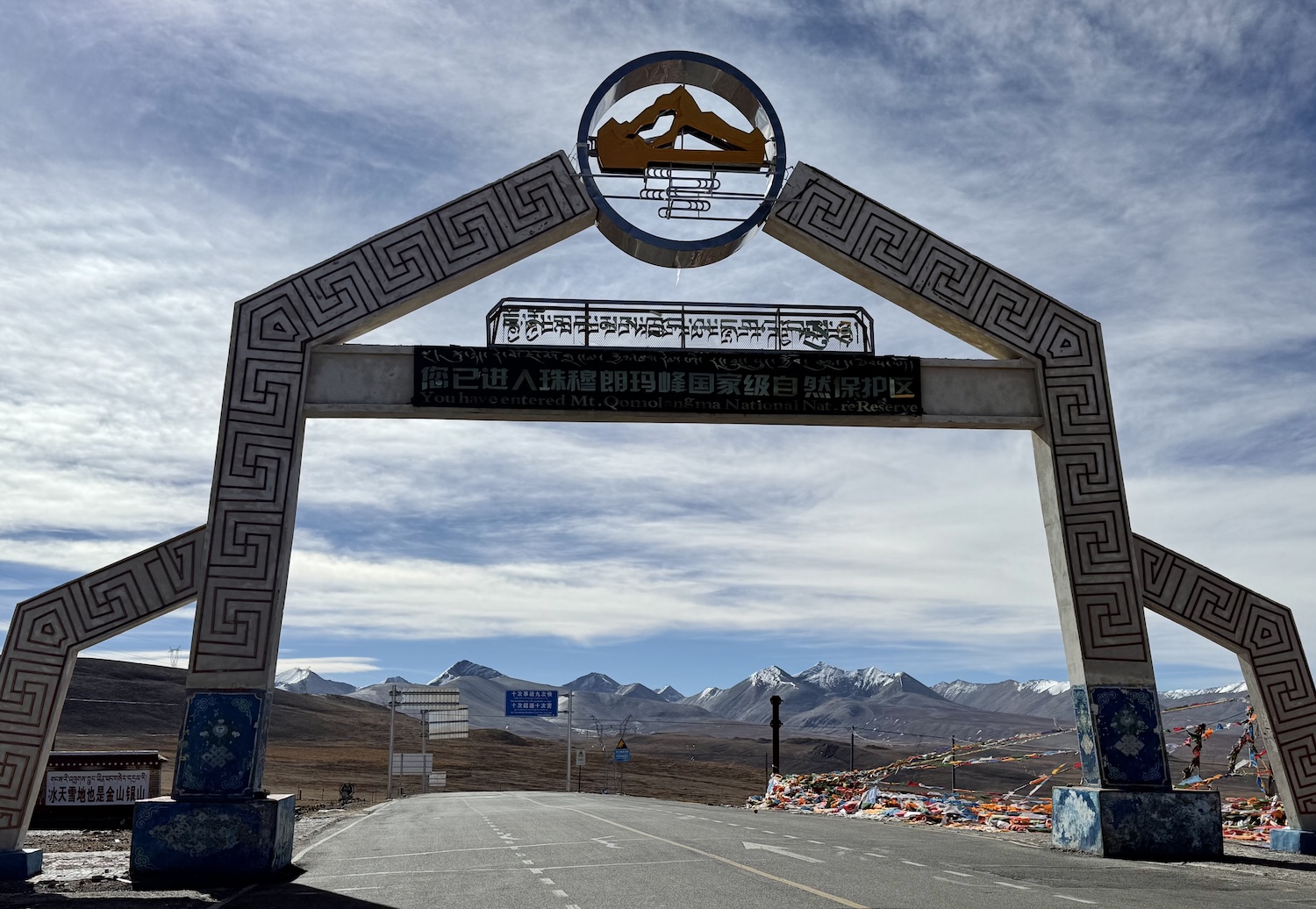
The Friendship Highway, which goes on to Kathmandu in Nepal, goes through brown arid mountains, with deep gorges in what feels like desert, and up to 5,248m at Gyatsola Pass. This is the Gateway to Qomolangma (Everest) National Park, where there are surprisingly few tourists as so many turn back at Shigatse.
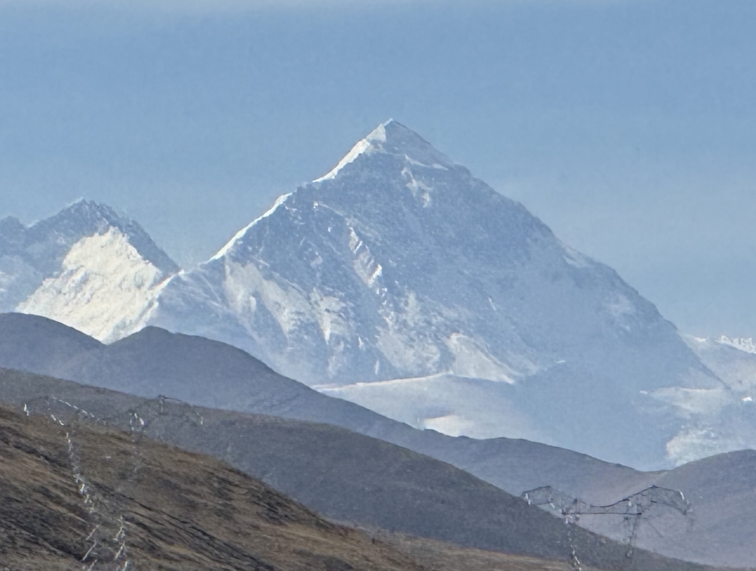
Soon after, we get our first view of Everest, looking like every child’s drawing of a mountain, and spend the next hour coming down a zigzag road that keeps Everest in vision nearly all the way, creeping closer and closer.
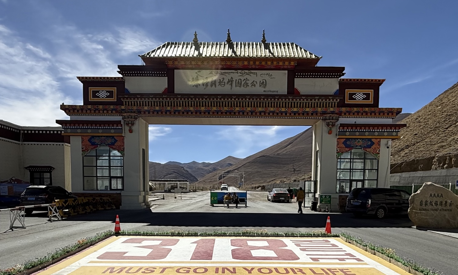
Surprisingly there are fields of barley and potatoes in the valleys between barren brown peaks, where the only other forms of life are cows, sheep and yaks. There is a military checkpoint with a full-scale passport, permit and vehicle check. It is not heavy, and there is no need even to get out of the car. Soon after the checkpoint, we turn off the Highway at Everest Gate.
The Himalaya were formed about 40 million years ago when India crashed into the Eurasian tectonic plate. As both sides are composed of buoyant continental crust, neither could sink below the other so they buckled and thrust the earth into the sky, creating the highest mountain range on the planet.
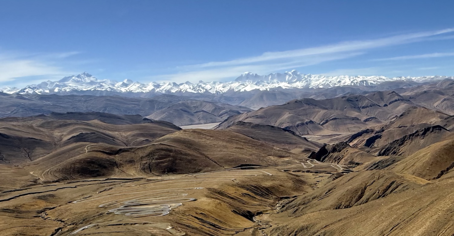
There are only fourteen mountains on earth over 8,000m – nine are in the Himalaya – and there is only one place you can see as many as five of them at once, including four of the six tallest in the world. That is here at the Gawula Pass, which is itself 5,198m high, where the only sound is the wind. From left to right they are Mount Makalu (8,463m, fifth highest in the world), Mount Lhotse (8,516m, fourth), Mount Everest (8,848m, first), Mount Cho Oyu (8,188m, sixth) and Mount Shishapangma (8,027, fourteenth). Standing alone taking in this extraordinary vista, the only sound the chill wind racing through, we found quite emotional.
At Zhaxizongxiang, we have to leave our minibus and join an electric eco-bus for the last 40km hour-long drive southwest to Rongbuk, the gateway to Everest. Astonishingly, the only seller of souvenirs, including Everest T-shirts, is a small shack right here; there are none at Base Camp. There is a police checkpoint on the way, where we have to show our passport, Tibet permit and Everest permit.
Rongbuk Monastery, the highest in the world, was built in the eighth century by the Red Hats. However, it was of course desecrated in the 1960s and only lately restored.
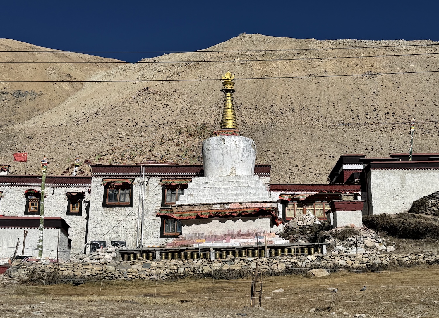
Rough and ready Rongbuk Hotel is directly opposite the monastery. It is at the head of a wide brown valley, near Everest Base Camp, at the end of which is Everest itself. We can even see it through the windows of the pleasant restaurant. Everyone we spoke to at breakfast reported that, like us, around 3-4am the oxygen levels had sunk so low they had to turn on the additional supplies in the bedroom.
The Tibetan Everest Base Camp was established in 1924 for a British expedition. We are not permitted to visit the tents of imminent climbers, but we can get our photo taken at the legendary Mount Qomolangma (Everest) Base Camp marker at 5,200m above sea level. It is immediately easy to see why this mountain has captured the imagination of the whole planet.
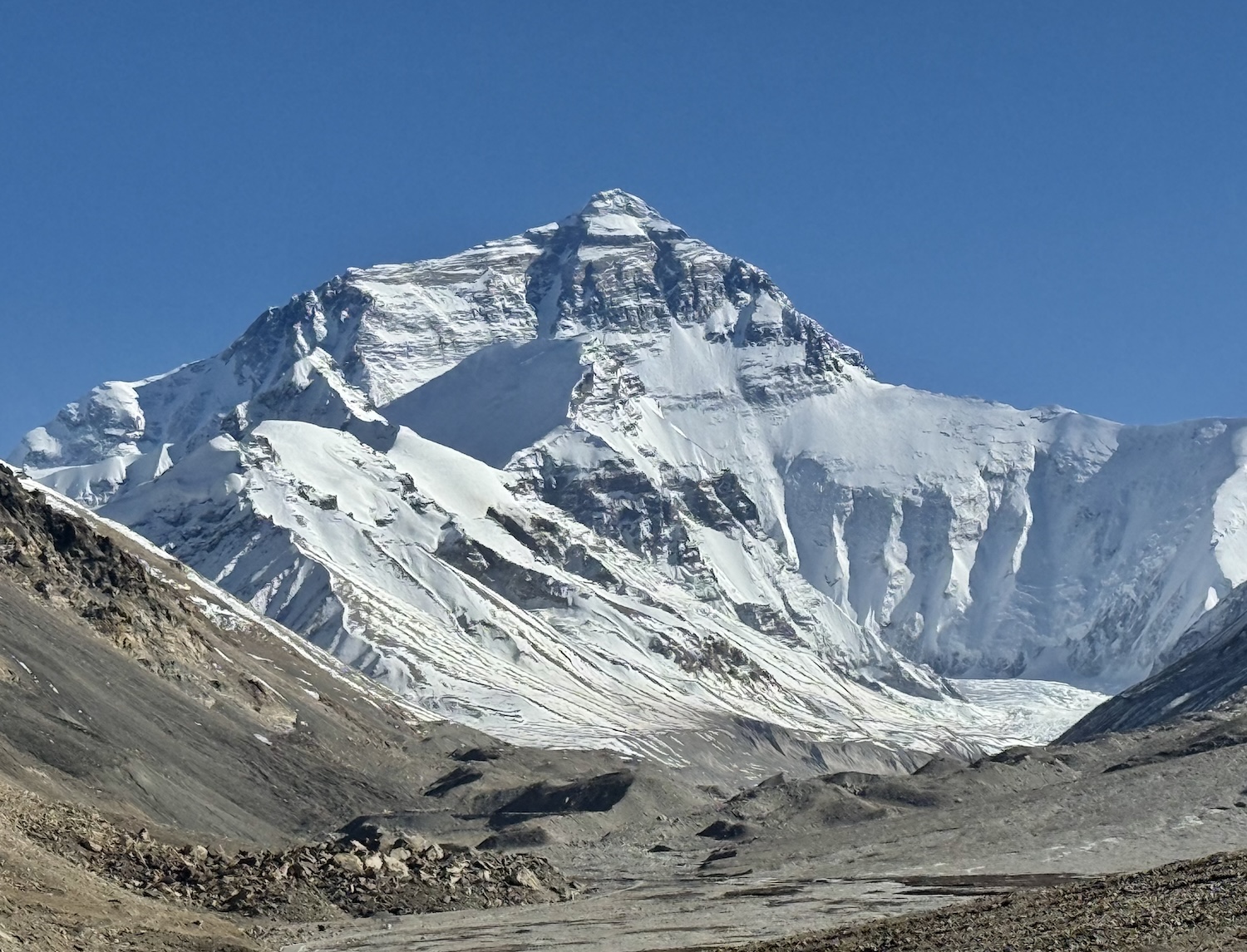
Even here there are CCTV cameras and an occasional police car to make sure there are no political protests.
Conquering Everest … because it’s there
Ascending the summit for the first time was not just a remarkable achievement of mountaineering, it was also a race entangled in early twentieth century geopolitics.
Inevitably, Britain led the way, with fourteen failed attempts between 1921 and 1938, all from the Tibetan north side. After World War Two, the Himalaya were closed by both Nepal and Tibet as they struggled with internal political upheavals involving India and China.
Nepal was the first to see the possible soft power opportunities of Everest, so it opened access to climbers again in 1951. While the British were still exploring possible South Face routes, the Swiss tried the southeast, unsuccessfully, in 1952.
Determined to raise the Union Jack at the top before anyone else got there, Britain recruited a mountaineer from New Zealander, Edmund Hilary, and a sherpa from Nepal, Tenzing Norgay. On an expedition that followed the Swiss’ Southeast Ridge, led by former British army officer John Hunt, Hilary and Tenzing were sent off ahead and reached the summit at 11.30am on 29 May 1953, just four days before the Coronation of Queen Elizabeth II. The tale is told in the gritty documentary with contemporary footage, Conquest of Everest, and the schmaltzy 2026 film, Tenzing.
Since then, about 8,000 people have been to the top of the world, taking an average of four-to-six days, though 350 have lost their lives trying. These days, it has become an urban myth that it is now so easy and so popular that people walk holding hands singing kumbaya up to the summit. In reality, about 800 try each year, mostly in the spring, only just over half successfully.
We arrived in the middle of the afternoon when the mountain was bright white under the deep blue sky. By sunset, when Chinese day-trippers started arriving, puffing at their oxygen canisters and waving their selfie sticks, it went through several gorgeous colour changes, from gold …
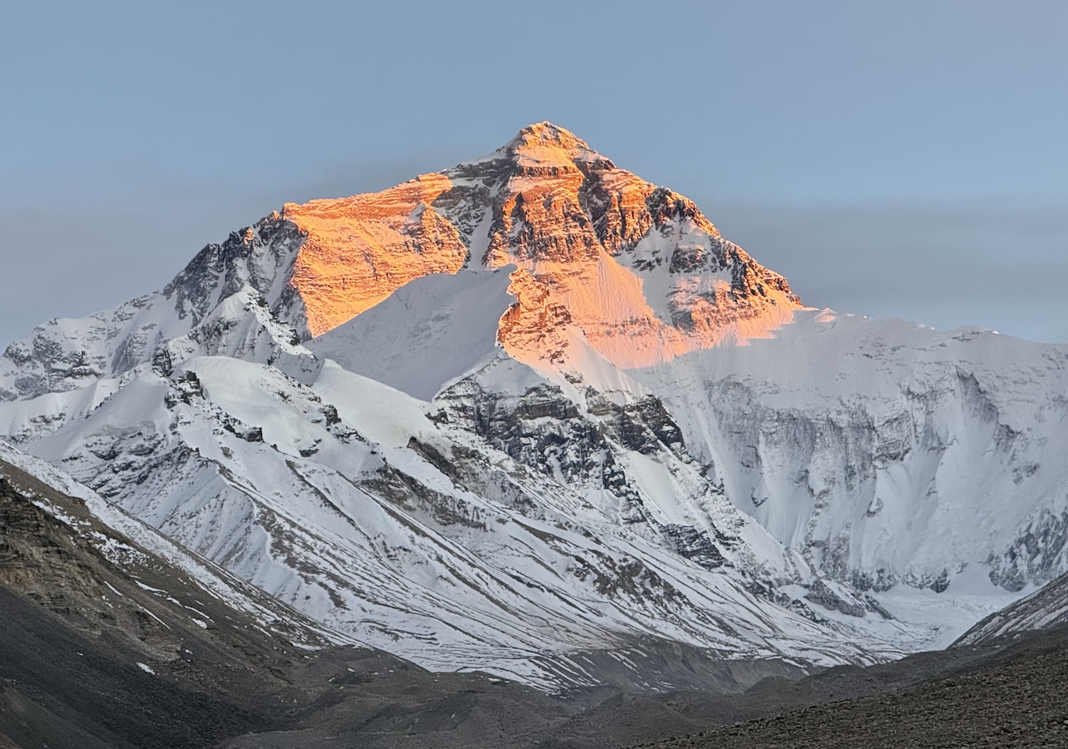
… to pink.
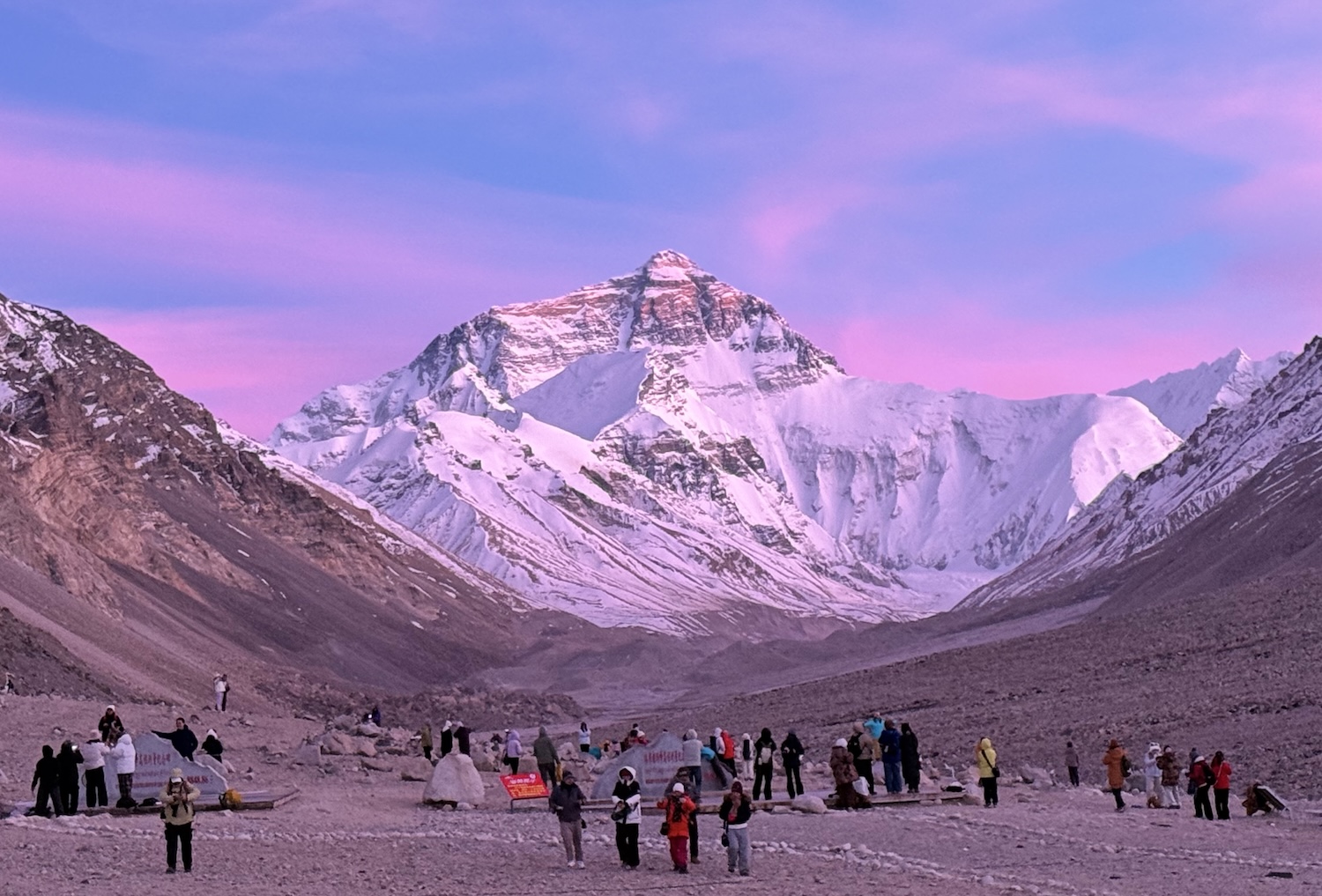
From Everest, many people used to go on to Kathmandu on the Friendship Highway, 600km and fifteen hours away. However, the overland border has been closed since the devastating earthquake of August 2026 shook the region, and it is widely expected it will now remain closed for years while it is repaired. Hence, we chose to return to Lhasa on the Yarlung Tsangpo River route, thereby picking up different perspectives of Everest and seeing temples that were missed coming down on the more popular Highway 318. I am sure we will see Everest from Nepal on another trip soon.
Thug-je-che-bo Tibet. You were genuinely awesome.